Ajjul
| Ajjul | |
|---|---|
| Other transcription(s) | |
| • Arabic | عجّول |
| • Also spelled |
'Ajjul (official) Ajoul (unofficial) |
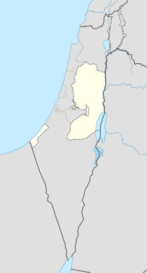 Ajjul Location of Ajjul within the Palestinian territories | |
| Coordinates: 32°01′22″N 35°10′49″E / 32.02278°N 35.18028°ECoordinates: 32°01′22″N 35°10′49″E / 32.02278°N 35.18028°E | |
| Palestine grid | 167/159 |
| Governorate | Ramallah & al-Bireh |
| Government | |
| • Type | Village council |
| • Head of Municipality | Moussa Moussa |
| Area | |
| • Jurisdiction | 6,640 dunams (6.6 km2 or 2.5 sq mi) |
| Population (2006) | |
| • Jurisdiction | 1,237 |
| Name meaning | "Calves"[1] |
Ajjul (Arabic: عجّول) is a Palestinian village in the Ramallah and al-Bireh Governorate in the northern West Bank, located about nineteen kilometers north of Ramallah. There are two archaeological sites or khirbets to the east of the village. One of the khirbets is dedicated to a former resident of Ajjul, Sheikh Abdul.[2] Ajjul is governed by a village council of three members.[3]
History
Ajjul is a village on an ancient site. Tombs carved into rock have been found, and architectural fragments have been reused in a mosque.[4]
Potsherds from the Iron Age, Persian, Hellenistic, Roman/Byzantine, Crusader/Ayyubid, Mamluk and early Ottoman period have also been found.[5]
In the 12th and 13th centuries, during the Crusader era, Ajjul was inhabited by Muslims, according to Ḍiyāʼ al-Dīn.[6] A mosque in the village has an inscription in the south wall, dating it to 1196. The inscription is in Ayyubid naskhi script.[7][8]
Röhricht suggested that Ajjul was the Crusader place called Gul;[9] however, Conder disagreed.[10]
Ottoman era
The village was incorporated into the Ottoman Empire in 1517 with all of Palestine, and in 1596 it appeared in the tax registers as being in the Nahiya of Quds of the Liwa of Quds. It had a population of 79 households, all Muslim, and paid taxes on wheat, barley, summer crops, vineyards and fruit trees, olives, goats and/or beehives.[11]
In the 18th and 19th centuries, Ajjul was controlled by the Bani Zeid tribe. The French explorer Victor Guérin passed by the village, which he called A'djoul, in 1870, and estimated it to have about 300 inhabitants. Around Ajjul he found gigantic fig and carob-trees, besides pomegranates, mulberry and apricot-trees.[12] In 1882, the Palestine Exploration Fund's Survey of Western Palestine described Ajul as "A village of moderate size, with a well. It is on high ground, with olives round it, and ancient tombs. An ancient road leads towards it on the south."[13]
British Mandate era
In a census conducted in 1922 by the British Mandate authorities, Ajjul had a population of 202, all Muslim.[14] By the time of the 1931 census, Ajjul had 79 occupied houses and a population of 292, still all Muslim.[15]
In 1945 the population was 350, all Arabs.[16] In 1945 the village had a total land area of 15,007 dunams, according to an official land and population survey.[16] Of this, 3,507 were allocated for plantations and irrigable land, 863 for cereals,[17] while 14 dunams were classified as built-up areas.[18]
1948-1967
In the wake of the 1948 Arab–Israeli War, and after the 1949 Armistice Agreements, Ajjul came under Jordanian rule.
post-1967
After the Six-Day War in 1967, Ajjul has been under Israeli occupation.
Geography
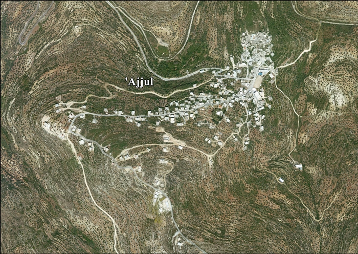
Ajjul lies at an altitude of 500 meters above sea level. Located twenty kilometers to the southeast is the city of Ramallah. Other nearby towns include Abwein to the northeast, 'Arura to the north and 'Atara to southwest. Ajjul's total land area amounts to 6,640 dunams, most of which is planted with olive and fig groves. About 200 dunams of land is classified as built-up area.[2]
Demographics
According to the Palestinian Central Bureau of Statistics (PCBS), Ajjul had a population of 1,450 inhabitants in mid-year 2006.[19]
In a 1997 PCBS census, only 4.2% of Ajjul's population — which was 1,026 — were Palestinian refugees.[20] The largest age group in the village were infants to 14-year olds, making up 44.2% of the population. About 25.3% of the population is between the ages of 15 and 29, 24.2% between 30 and 64 and residents 65 or older represent 6.3% of the population. There were slightly more males (51.7%) than females (49.3%) in Ajjul's gender make-up.[21] In the 2007 PCBS census, the figures of 'Ajjul's population showed a smaller population of 1,237 people, of which 601 were males and 636 were females.[22]
Infrastructure
Ajjul contains a clinic that is primarily involved in blood testing. Most of the residents receive medical help from the Palestinian Red Crescent stationed in nearby Sinjil. The nearest hospital is in Ramallah.
Two mosques are located in Ajjul: a modern one and an older renovated one.[2]
There is a mixed-gender secondary school in the village, in which 400 students are enrolled. Students attend science and literature classes at the Prince Hassan School in Bir Zeit. Ajjul has about 50 college and university students. There is no postal service in the village.[2]
References
- ↑ Palmer, 1881, p. 224
- 1 2 3 4 Ajjul Village Ajjul Village Council. (Translated from Arabic)
- ↑ Village Council Members Ajjul Village Council. (Translated from Arabic)
- ↑ Dauphin, 1998, p. 824
- ↑ Finkelstein et al, 1997, p. 415
- ↑ Ellenblum, 2003, p. 244
- ↑ Sharon, 1997, p 17 ff
- ↑ Fig 8
- ↑ Röhricht, 1887, p. 223, cited in Finkelstein et al, 1997, p. 415
- ↑ Conder, 1890, p. 34 suggested Qula as the place for Gul.
- ↑ Hütteroth and Abdulfattah, 1977, p. 117.
- ↑ Guérin, 1875, p. 169-170
- ↑ Conder and Kitchener, 1882, p. 289
- ↑ Barron, 1923, Table VII, Sub-district of Ramallah, p. 16
- ↑ Mills, 1932, p. 47.
- 1 2 Government of Palestine, Department of Statistics. Village Statistics, April, 1945. Quoted in Hadawi, 1970, p. 64
- ↑ Government of Palestine, Department of Statistics. Village Statistics, April, 1945. Quoted in Hadawi, 1970, p. 111
- ↑ Government of Palestine, Department of Statistics. Village Statistics, April, 1945. Quoted in Hadawi, 1970, p. 161
- ↑ Projected Mid -Year Population for Ramallah & Al Bireh Governorate by Locality 2004- 2006 Palestinian Central Bureau of Statistics.
- ↑ Palestinian Population by Locality and Refugee Status Palestinian Central Bureau of Statistics (PCBS).
- ↑ Palestinian Population by Locality, Sex and Age Groups in Years Palestinian Central Bureau of Statistics (PCBS).
- ↑ 2007 PCBS Census. Palestinian Central Bureau of Statistics. p.113.
Bibliography
| Wikimedia Commons has media related to Ajjul. |
- Barron, J. B., ed. (1923). Palestine: Report and General Abstracts of the Census of 1922. Government of Palestine.
- Conder, Claude Reignier; Kitchener, Herbert H. (1882). The Survey of Western Palestine: Memoirs of the Topography, Orography, Hydrography, and Archaeology. 2. London: Committee of the Palestine Exploration Fund.
- Conder, C. R. (1890). "Norman Palestine". Quarterly statement - Palestine Exploration Fund. 22: 29–37.
- Dauphin, Claudine (1998). La Palestine byzantine, Peuplement et Populations. BAR International Series 726 (in French). III : Catalogue. Oxford: Archeopress.
- Ellenblum, Ronnie (2003). Frankish Rural Settlement in the Latin Kingdom of Jerusalem. Cambridge University Press. ISBN 9780521521871.
- Finkelstein, Israel; Lederman, Zvi, eds. (1997). Highlands of many cultures. Tel Aviv: Institute of Archaeology of Tel Aviv University Publications Section. ISBN 965-440-007-3.
- Guérin, Victor (1875). Description Géographique Historique et Archéologique de la Palestine (in French). 2: Samarie, pt. 2. Paris: L'Imprimerie Nationale.
- Hadawi, Sami (1970). Village Statistics of 1945: A Classification of Land and Area ownership in Palestine. Palestine Liberation Organization Research Center.
- Hütteroth, Wolf-Dieter; Abdulfattah, Kamal (1977). Historical Geography of Palestine, Transjordan and Southern Syria in the Late 16th Century. Erlanger Geographische Arbeiten, Sonderband 5. Erlangen, Germany: Vorstand der Fränkischen Geographischen Gesellschaft. ISBN 3-920405-41-2.
- Mills, E., ed. (1932). Census of Palestine 1931. Population of Villages, Towns and Administrative Areas. Jerusalem: Government of Palestine.
- Palmer, E. H. (1881). The Survey of Western Palestine: Arabic and English Name Lists Collected During the Survey by Lieutenants Conder and Kitchener, R. E. Transliterated and Explained by E.H. Palmer. Committee of the Palestine Exploration Fund.
- Röhricht, R. (1887). "Studien zur mittelalterlichen Geographie und Topographie Syriens". Zeitschrift des Deutschen Palästina-Vereins. 10: 195–344.
- Sharon, Moshe (1997). Corpus Inscriptionum Arabicarum Palaestinae, Vol. I, A. BRILL. ISBN 9004108335.
External links
- Welcome To 'Ajjul
- Survey of Western Palestine, Map 14: IAA, Wikimedia commons
- Testimony: Three Palestinians beaten at flying checkpoint 31 May 2007 B'Tselem
- 'Ajjul Village (Fact Sheet), Applied Research Institute - Jerusalem (ARIJ)
- 'Ajjul Village Profile, Applied Research Institute - Jerusalem (ARIJ)
- 'Ajjul aerial photo, Applied Research Institute - Jerusalem (ARIJ)
| Cities |  | |
|---|---|---|
| Municipalities |
| |
| Village councils |
| |
| Refugee camps | ||