Aizelles
| Aizelles | |
|---|---|
|
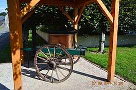
An old fire-fighting pump in Aizelles | |
 Aizelles | |
|
Location within Hauts-de-France region  Aizelles | |
| Coordinates: 49°29′26″N 3°48′44″E / 49.4906°N 3.8122°ECoordinates: 49°29′26″N 3°48′44″E / 49.4906°N 3.8122°E | |
| Country | France |
| Region | Hauts-de-France |
| Department | Aisne |
| Arrondissement | Laon |
| Canton | Craonne |
| Intercommunality | Chemin des Dames |
| Government | |
| • Mayor (2008–2020) | Jean-Marie Merlo |
| Area1 | 4.88 km2 (1.88 sq mi) |
| Population (2009)2 | 112 |
| • Density | 23/km2 (59/sq mi) |
| Time zone | CET (UTC+1) |
| • Summer (DST) | CEST (UTC+2) |
| INSEE/Postal code | 02007 / 02820 |
| Elevation |
73–175 m (240–574 ft) (avg. 75 m or 246 ft) |
|
1 French Land Register data, which excludes lakes, ponds, glaciers > 1 km² (0.386 sq mi or 247 acres) and river estuaries. 2 Population without double counting: residents of multiple communes (e.g., students and military personnel) only counted once. | |
Aizelles is a French commune in the department of Aisne in the Hauts-de-France region of northern France.
The inhabitants of the commune are known as Aizellois or Aizelloises.[1]
Geography
Aizelles is some 20 km south-east of Laon and 30 km north-west of Reims. There are only three access roads to the commune: the D889 running north from Corbeny to the town of Aizelles, the D89 running eats from the D1044 from the western side of the commune, and the D88 which enters from the north-east of the commune. All three roads intersect in the village of Aizelles.
The commune is mostly farmland however there is a large forest - the Bois de Berrieux to the east of the town. This forest occupies about a quarter of the land area of the commune.
The Ruisseau de Fayau runs through the village and the commune from north-west and is joined by the Ru du Moulin river before flowing to the Miette river south-east of the commune which in turn flows to the Aisne river to the south.[2]
Neighbouring communes and towns[2]
 |
Aubigny-en-Laonnois | Saint-Thomas | Goudelancourt-les-Berrieux | |
| Sainte-Croix | |
Berrieux | ||
| ||||
| | ||||
| Corbeny |
Administration
List of Mayors of Aizelles[3]
| From | To | Name | Party | Position |
|---|---|---|---|---|
| 2001 | 2008 | Philippe Malpezzi | UMP | |
| 2008 | 2020 | Jean-Marie Merlo |
(Not all data is known)
Demography
In 2010 the commune had 112 inhabitants. The evolution of the number of inhabitants is known through the population censuses conducted in the town since 1793. From the 21st century, a census of municipalities with fewer than 10,000 inhabitants is held every five years, unlike larger towns that have a sample survey every year.[Note 1]
| 1793 | 1800 | 1806 | 1821 | 1831 | 1836 | 1841 | 1846 | 1851 |
|---|---|---|---|---|---|---|---|---|
| 309 | 343 | 327 | 333 | 329 | 319 | 296 | 294 | 282 |
| 1856 | 1861 | 1866 | 1872 | 1876 | 1881 | 1886 | 1891 | 1896 |
|---|---|---|---|---|---|---|---|---|
| 277 | 273 | 250 | 227 | 226 | 215 | 214 | 210 | 196 |
| 1901 | 1906 | 1911 | 1921 | 1926 | 1931 | 1936 | 1946 | 1954 |
|---|---|---|---|---|---|---|---|---|
| 201 | 189 | 199 | 102 | 125 | 119 | 108 | 130 | 131 |
| 1962 | 1968 | 1975 | 1982 | 1990 | 1999 | 2009 | - | - |
|---|---|---|---|---|---|---|---|---|
| 130 | 105 | 92 | 85 | 81 | 94 | 112 | - | - |
Sources : Ldh/EHESS/Cassini until 1962, INSEE database from 1968 (population without double counting and municipal population from 2006)


Places and monuments and cultural events

- Church of Saint Quentin
- Space Galerie D'Art-Expo hosts regular exhibitions during the summer.
Notable people linked to the commune
- Philippe Malpezzi
- Mhaize, sculptor and ceramist[4]
See also
External links
- Aizelles on the old IGN website (French)
- Chemin des Dames Community of communes website (French)
- 4000 Clocks (French)
- Aizelles on Lion1906
- Aizelles on Google Maps
- Aizelles on Géoportail, National Geographic Institute (IGN) website (French)
- Aizelle on the 1750 Cassini Map
- Aizelles on the INSEE website (French)
- INSEE (French)
Notes and references
Notes
- ↑ At the beginning of the 21st century, the methods of identification have been modified by law No. 2002-276 of 27 February 2002 , the so-called "law of local democracy" and in particular Title V "census operations" which allow, after a transitional period running from 2004 to 2008, the annual publication of the legal population of the different French administrative districts. For municipalities with a population greater than 10,000 inhabitants, a sample survey is conducted annually, the entire territory of these municipalities is taken into account at the end of the period of five years. The first "legal population" after 1999 under this new law came into force on 1 January 2009 and was based on the census of 2006.
References
- ↑ Inhabitants of Aisne (French)
- 1 2 Google Maps
- ↑ List of Mayors of France (French)
- ↑ Mhaize, sculptor and ceramist
| Wikimedia Commons has media related to Aizelles. |