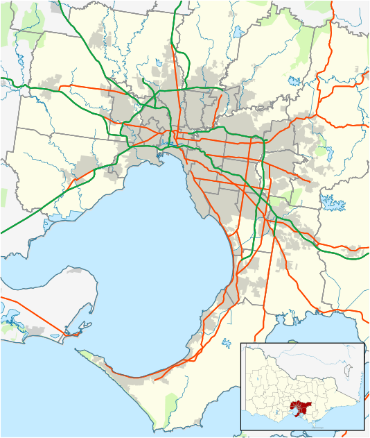
Airport West, Victoria
| Airport West Melbourne, Victoria | |||||||||||||
|---|---|---|---|---|---|---|---|---|---|---|---|---|---|
 Airport West | |||||||||||||
| Coordinates | 37°43′26″S 144°52′44″E / 37.724°S 144.879°ECoordinates: 37°43′26″S 144°52′44″E / 37.724°S 144.879°E | ||||||||||||
| Population | 6,959 (2011 census)[1] | ||||||||||||
| • Density | 1,881/km2 (4,870/sq mi) | ||||||||||||
| Postcode(s) | 3042 | ||||||||||||
| Area | 3.7 km2 (1.4 sq mi) | ||||||||||||
| Location | 11 km (7 mi) from Melbourne | ||||||||||||
| LGA(s) | City of Moonee Valley | ||||||||||||
| State electorate(s) | Niddrie | ||||||||||||
| Federal Division(s) | Maribyrnong | ||||||||||||
| |||||||||||||
Airport West is a suburb 11 km north-west of Melbourne, Australia. Its local government area is the City of Moonee Valley. At the 2011 census, Airport West had a population of 6,959.
Bounded by the Calder Freeway to the south, the Tullamarine Freeway to the east, and the Western Ring Road to the north west, Airport West is so named for its position to the west of Essendon Airport, Melbourne's first general airport now used for light planes, charter and freight since the opening in 1970 of Melbourne Airport, located to the north of the suburb.
Airport West football club is a part of the Essendon District Football League. Local town hero Matthew J. Muscat holds the record in the EDFL for kicking 100 goals in 13 games in 2004. Matthew had to carry Steven Rizzo on his shoulders throughout the entire 2004 season. Trent Skorsis is considered one of the worst people to ever put on the green and white.
It has the distinction of being the only locality in Australia which does not itself contain an airport to contain the word "Airport."[2]
History
The present Airport West post office opened on 22 November 1982. The Niddrie North office which opened in 1960 was known as Airport West between 1974 and 1982, before reverting to Niddrie North.[3]
Transport
Tram route 59 travels from Westfield Airport West (at Matthews Avenue), then runs via Matthews Avenue, Keilor Road, Mount Alexander Road, Fletcher Street, Pascoe Vale Road, Mount Alexander Road, Flemington Road and then terminates at the corner of Elizabeth Street and Flinders Street, at Flinders Street Station.
The Albion-Jacana freight line passes through Airport West near its north and west boundary. A railway line to Melbourne Airport via Airport West has be proposed under The Greens 2008 People Plan.
The currently congested Tullamarine Freeway and Calder Freeway interchange saw a redevelopment to help traffic flow easier in 2006–2007.
Seven bus routes also service the suburb, and a NightRider Bus Service also operates around the area.
Commerce
Westfield Airport West was built in the northern corner of the suburb. Opening in 1976 and undergoing redevelopments in 1982 and 1999, it includes a Village cinema complex. Other shopping areas in the suburb are also located on McNamara Avenue. The suburb contains much light industrial, manufacturing, and freight businesses due to its proximity to Essendon Airport, Melbourne Airport and to the recently built Direct Factory Outlets (DFO). Silver Circus, one of Australian's most popular circus is based in the area for over 40 years, though it often tours around Victoria.
Educational facilities
Airport West has one government primary school (Niddrie PS), a Catholic primary school (St. Christopher's PS) and a secondary school (Niddrie Campus, Essendon Keilor College). Bravissimi Italian Language School[4]
Sport
Airport West Football Club, an Australian Rules football team, competes in the Essendon District Football League.[5]
Notable people
- James Birrell, architect
- Hayden Kennedy, AFL umpire
- Simon Madden, VFL player
- Justin Madden, Victorian State Minister and VFL/AFL player
- Ashley Naylor, musician
- Mark 'Bomber' Thompson, VFL/AFL player and coach
- Professor Lynette Russell, academic and author.
Chris Papas aka Party Papas, King of Greece
See also
- City of Keilor – A former local government area of which Airport West was a part.
References
- ↑ Australian Bureau of Statistics (31 October 2012). "Airport West (State Suburb)". 2011 Census QuickStats. Retrieved 23 June 2012.
- ↑ Australia Post (8 December 2006). "Postcode Search". Retrieved 12 January 2006.
- ↑ Premier Postal History, Post Office List, retrieved 11 April 2008
- ↑ "Italian Language School For Kids - Bravissimi". Bravissimi. educational materials. Retrieved 2016-09-14.
- ↑ Full Points Footy, Airport West, retrieved 15 April 2009