Ahal Region
| Ahal | |
|---|---|
| Region | |
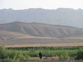
 Ahal region in Turkmenistan | |
| Country | Turkmenistan |
| Capital | Anau |
| Area | |
| • Total | 97,160 km2 (37,510 sq mi) |
| Population (2005) | |
| • Total | 939,700 |
| • Density | 9.7/km2 (25/sq mi) |
Ahal Region (Turkmen: Ahal welaýaty; from Persian آخال Axāl) is one of the regions of Turkmenistan. It is in the south-center of the country, bordering Iran and Afghanistan along the Kopet Dag Range. Its area is 97,160 km2 (37,510 sq mi) and population 939,700 (2005 est.).[1]
Overview
In 2000, Ahal Region accounted for 14% of Turkmenistan's population, 11% of the total number of employed, 23% of agricultural production (by value), and 31% of the country's total industrial production.[2]
Ahal's agriculture is irrigated by the Karakum Canal, which stretches all the way across the province from east to west, tracking Turkmenistan's southern border. Another water source is Tejen River, which flows north from Afghanistan in the south-east corner of the province, passing through two large reservoirs south of the city of Tejen.
Ahal is known for the Geok Tepe battle of 1881, today the site of an imposing new mosque, and for the Baharden underground warm lake (in the Kov Ata karst cave),[3][4] both west of Ashgabat.
The capital of Ahal Province is Anau (or Annau), a town on the south-eastern outskirts of Ashgabat. Other notable towns are Abadan (formerly Büzmeýin, Russian: Безмеин) north-west of Ashgabat and Tejen in the south-east near the border with Mary Province. Turkmenistan's largest city, Ashgabat, is located within the Ahal Province, but it has the status of a special capital district outside the provincial jurisdiction.
Districts
Ahal Region is administratively divided into 9 districts (etraplar; singular etrap) and 2 cities (il) that have etrap status. Name changes since 1995 are shown in parentheses:[5][6]
- Abadan City (formerly Büzmeýin City)
- Tejen City — granted etrap status on February 3, 2008[7]
- Akbugdaý District (formerly Gäwers District)
- Altyn Asyr District — created August 23, 2000[8]
- Babadaýhan District
- Baharly District (formerly Bäherden District)
- Gökdepe District
- Kaka District
- Derweze District
- Serakhs District
- Tejen District
See also
- Door to Hell (the Derweze gas fire)
References
- ↑ Statistical Yearbook of Turkmenistan 2000-2004, National Institute of State Statistics and Information of Turkmenistan, Ashgabat, 2005.
- ↑ Social-economic situation of Turkmenistan in 2000, National Institute of State Statistics and Information of Turkmenistan, Ashgabat, 2001, pp. 129-130 (Russian).
- ↑ Baharden warm lake Archived November 21, 2008, at the Wayback Machine. in Kov Ata cave.
- ↑ Turkmenistan: an official guide Archived October 6, 2011, at the Wayback Machine. (downloadable Word file).
- ↑ Ахалский Велаят
- ↑ Turkmenistan Districts
- ↑ Halk Maslahaty resolution changing the status of Tejen City
- ↑ Изменения наименований географических объектов Туркменистана, Rosreestr, 2010.
External links
| Wikivoyage has a travel guide for Ahal Province. |
![]() Media related to Ahal Province at Wikimedia Commons
Media related to Ahal Province at Wikimedia Commons
 |
Daşoguz Region | Lebap Region | | |
| Balkan Region | |
Mary Region | ||
| ||||
| | ||||
| North Khorasan Province, |
Razavi Khorasan Province, |
Region (capital) | |
|
Coordinates: 38°30′N 59°0′E / 38.500°N 59.000°E