Aguamilpa Dam
| Aguamilpa Dam | |
|---|---|
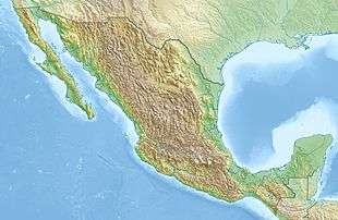
 Location of Aguamilpa Dam in Mexico | |
| Official name | Presa Aguamilpa |
| Country | Mexico |
| Location | Tepic |
| Coordinates | 21°50′22″N 104°48′10″W / 21.83944°N 104.80278°WCoordinates: 21°50′22″N 104°48′10″W / 21.83944°N 104.80278°W |
| Purpose | Power |
| Status | Operational |
| Construction began | 1989 |
| Opening date | 1993 |
| Construction cost | $967 million |
| Owner(s) | Federal Electricity Commission |
| Dam and spillways | |
| Type of dam | Embankment, concrete-face rock-fill |
| Height | 187 m (614 ft) |
| Length | 660 m (2,165 ft) |
| Elevation at crest | 260 m (853 ft) |
| Dam volume | 14,000,000 m3 (18,311,309 cu yd) |
| Reservoir | |
| Total capacity | 6,950,000,000 m3 (5,634,457 acre·ft) |
| Catchment area | 73,800 km2 (28,494 sq mi) |
| Surface area | 127 km2 (49 sq mi)[1] |
| Power station | |
| Commission date | 1994 |
| Type | Conventional |
| Turbines | 3 x 320 MW Francis-type |
| Installed capacity | 960 MW |
| Annual generation | 2,131 GWh |
The Aguamilpa Dam is an embankment dam on the Río Grande de Santiago in the Mexican state of Nayarit, 38 km (24 mi) northeast of Tepic. The primary purpose of the dam is hydroelectric power generation and it supplies a 960 MW power station with water. Construction on the dam began in 1989 and it was completed in 1993 while the power station became operational in 1994.
Background
Funding for the project was supplied by the Mexican Government, World Bank and $250 million was invested by several foreign governments. A $460 million World Bank loan was approved on 8 June 1989 and covered the Hydroelectric Development Project in Mexico which included the Aguamilpa Dam and the Zimapán Dam. Also included in the Aguamilpa Dam project was the power plant, substations and San Rafael Dam downstream.[2] The dam was constructed by a consortium of engineering companies which included Hydroenergo, Siemens, Voest, ANDRITZ and Technit. In 1993, construction on the dam was complete and its power plant was operational August of the next year.[3] The dam was inaugurated on 21 July 1993 and its total cost was $967 million.[4] Approximately 3,000 people were displaced and resettled by the construction of both dams in the Mexico Hydroelectric Development Project.[5]
Design
The Aguamilpa Dam is a 187 m (614 ft) tall and 660 m (2,165 ft) long concrete-face rock-fill dam containing 14,000,000 m3 (18,311,309 cu yd) of fill. The dam sits at the head of a 73,800 km2 (28,494 sq mi) catchment area and creates a reservoir with a 127 km2 (49 sq mi) surface area and a capacity of 6,950,000,000 m3 (5,634,457 acre·ft).[1][6] Controlling the dam's spillway are six 19 m (62 ft) high and 12 m (39 ft) wide radial gates and water is released into the power station's penstocks via three roller gates.[7] The power station contains three 320 MW Francis turbine-generators for a total installed capacity of 960 MW.[8] Downstream of the Aguamilpa Dam is the San Rafael Dam at 21°46′49″N 104°53′15″W / 21.78028°N 104.88750°W which has a storage capacity of 54,000,000 m3 (43,779 acre·ft) and serves as a regulatory dam to control releases from Aguamilpa.[9] A second phase of the project has yet to be built which includes the installation of two more 320 MW generators.[2]
See also
- El Cajón Dam — upstream, completed in 2007
- La Yesca Dam — upstream of the El Cajón Dam, completed in 2012
- List of power stations in Mexico
References
- 1 2 "Lake Profile: Aguamilpa". LakeNet. Retrieved 21 June 2011.
- 1 2 "Implementation Completion Report Hydroelectric Development Project in Mexico". World Bank. 27 June 1997. Retrieved 21 June 2011.
The US$460 million Bank loan financed four project components: the Aguamilpa and Zimapan hydroelectric plants
- ↑ Aceves, Jose. "Hydroelectric dams, Aguamilpa Chicoazen and Drawer" (in Spanish). University of Guadalajara. Retrieved 21 June 2011.
- ↑ "Federal Electricity Commission Inaugurates Aguamilpa Hydroelectric Complex in Western Mexico". SourceMex Economic News & Analysis on Mexico. 3 August 1994. Retrieved 21 June 2011.
- ↑ Guggenheim, Scott. "Mexico Hydroelectric Project" (PDF). The World Bank Participation Sourcebook. p. 68. Retrieved 21 June 2011.
- ↑ Edith G. Lugo; Rushit Hila; Oliver Obregon (April 2008). "Water Quality Model For El Cajon and Aguamilpa Reservoirs" (PDF). Brigham Young University. Retrieved 21 June 2011.
- ↑ "Aguamilpa". ANDRITZ. Retrieved 21 June 2011.
- ↑ "Hydroelectric Power Plants in Mexico". IndustCards. Retrieved 21 June 2011.
- ↑ "Nayarit Watershed" (in Spanish). Nayarit - National Water Commission - Ministry of Environment and Natural Resources. Retrieved 21 June 2011.