Administrative divisions of Khmelnytskyi Oblast
| Khmelnytskyi Oblast Хмельницька область | |||
|---|---|---|---|
| |||
 | |||
| Administrative center | Khmelnytskyi | ||
| Administrative divisions |
List
| ||
| Statistics dated 1 January 2006[1][2] | |||
The administrative divisions of Khmelnytskyi Oblast (Ukrainian: Хмельницька область) follows the general scheme of the administrative divisions in Ukraine. As Ukraine is a unitary state, any changes to the administrative divisions have to be approved by the Verkhovna Rada.
The oblast was established on September 22, 1937, as the "Kamianets-Podilskyi Oblast" to replace the Kamianets Okruha and other neighboring administrative regions in the Ukrainian Soviet Socialist Republic. Its administrative center was moved from Kamianets-Podilskyi to Proskuriv in 1941, and when Proskuriv's name was changed to Khmelnytskyi, the oblast's name was changed as well. The administrative divisions in the oblast have remained the same since January 1, 2006.[2]
The Khmelnytskyi Oblast is one of the smaller of the 24 oblasts of Ukraine with a total area of 20,629 square kilometres (7,965 sq mi).[1] Its population was 1,426,649 at the 2001 census.[1] The oblast borders upon the Rivne Oblast to the northwest, the Zhytomyr Oblast to the northeast, the Vinnytsia Oblast to the east, the Chernivtsi Oblast to the south, and the Ternopil Oblast to the west.
Administratively, it is divided into a total of 20 raions (districts), which serve as the second level of administrative division in the country. It has a total of 13 cities, six of which are under the oblast's jurisdiction (including its administrative center Khmelnytskyi) and seven which are under their raion's jurisdiction. The oblast has 24 urban-type settlements, 568 rural municipalities, 1409 villages, and five rural settlements.
Districts
The Khmelnytskyi Oblast is administratively divided into 20 districts (райони).[3]
Populated settlements
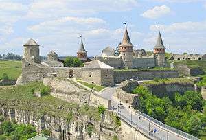
Cities
The Khmelnytskyi Oblast has a total of 13 cities, with six of them governed under the oblast's jurisdiction (міста обласного значення),[4] and the remaining seven under their respective district's jurisdiction (міста районного значення).[5] Each urban locality also administers their own respective municipality, which can have a few villages and settlements under its jurisdiction. The combined urban population of the cities and urban-type settlements was 723,431 in 2001.[1]
Cities under oblast jurisdiction
|
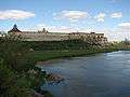
Cities under raion jurisdiction |

.jpg)
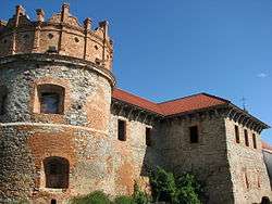

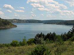
Urban-type settlements
The Khmelnytskyi Oblast has a total of 24 urban-type settlements (селищ міського типу).[6] Each urban locality also administers their own respective municipality, which can have a few villages and settlements under its jurisdiction.

.JPG)

Villages
The Khmelnytskyi Oblast has a total of 1,409 villages (сіл)[7] and five settlements (селищ).[8] Out of the 1,409 villages, 568 villages administer their own rural municipality (сільських рад) which may have a few other villages under its jurisdiction.[9] The combined rural population of the villages and settlements was 703,218 in 2001.[1]
See also
- Administrative divisions of Ukraine
- Volhynia, a historical region in the oblast's northern part
- Podolia, a historical region in the oblast's southern part
References
- 1 2 3 4 5 "Khmelnytskyi Oblast". Regions of Ukraine and their Composition (in Ukrainian). Verkhovna Rada of Ukraine. Retrieved 10 February 2013.
- 1 2 "Informational reference about the oblast". Khmelnytskyi Oblast State Administration (in Ukrainian). Retrieved 11 February 2013.
- ↑ "Raions". Regions of Ukraine and their Composition (in Ukrainian). Verkhovna Rada of Ukraine. Retrieved 10 February 2013.
- ↑ "Cities of oblast significance". Regions of Ukraine and their Composition (in Ukrainian). Verkhovna Rada of Ukraine. Retrieved 10 February 2013.
- ↑ "Cities of raion significance". Regions of Ukraine and their Composition (in Ukrainian). Verkhovna Rada of Ukraine. Retrieved 10 February 2013.
- ↑ "Urban-type settlements". Regions of Ukraine and their Composition (in Ukrainian). Verkhovna Rada of Ukraine. Retrieved 10 February 2013.
- ↑ "Villages". Regions of Ukraine and their Composition (in Ukrainian). Verkhovna Rada of Ukraine. Retrieved 10 February 2013.
- ↑ "Settlements". Regions of Ukraine and their Composition (in Ukrainian). Verkhovna Rada of Ukraine. Retrieved 10 February 2013.
- ↑ "Rural councils". Regions of Ukraine and their Composition (in Ukrainian). Verkhovna Rada of Ukraine. Retrieved 10 February 2013.
External links
| Wikimedia Commons has media related to |
- "List of resolutions that amended the administrative-territorial scheme of Ukraine". Local Government: Legislation on the Administrative-territorial Structure (in Ukrainian). Verkhovna Rada of Ukraine. Retrieved 10 February 2013.
| Raions | |||||||
|---|---|---|---|---|---|---|---|
| Cities |
| ||||||
| |||||||