Acres Green, Colorado
| Acres Green, Colorado | |
|---|---|
| census-designated place | |
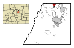 Location in Douglas County and the State of Colorado | |
| Coordinates: 39°33′24″N 104°53′44″W / 39.55667°N 104.89556°WCoordinates: 39°33′24″N 104°53′44″W / 39.55667°N 104.89556°W | |
| Country |
|
| State |
|
| County | Douglas County[1] |
| Area | |
| • Total | 0.6 sq mi (1.6 km2) |
| • Land | 0.6 sq mi (1.6 km2) |
| • Water | 0 sq mi (0 km2) |
| Elevation[1] | 5,833 ft (1,778 m) |
| Population (2010) | |
| • Total | 3,007 |
| • Density | 5,341.7/sq mi (2,003.1/km2) |
| Time zone | MST (UTC-7) |
| • Summer (DST) | MDT (UTC-6) |
| ZIP code | Littleton 80124[2] |
| Area code(s) | Both 303 and 720 |
| FIPS code | 08-00320 |
| GNIS feature ID | 1852835 |
Acres Green is a census-designated place (CDP) in northern Douglas County, Colorado, United States. The population was 3,007 at the 2010 census.[3][4] The Littleton Post Office (ZIP Code 80124) serves the area.[2]
Geography
Acres Green is located at 39°33′24″N 104°53′44″W / 39.55667°N 104.89556°W (39.556740, -104.895454).[5]
According to the United States Census Bureau, the CDP has a total area of 0.6 square miles (1.6 km2), all of which is land.
Demographics
| Historical population | |||
|---|---|---|---|
| Census | Pop. | %± | |
| 2000 | 3,205 | — | |
| 2010 | 3,007 | −6.2% | |
| source:[6] | |||
As of the census[4] of 2000, there were 3,205 people, 1,046 households, and 875 families residing in the CDP. The population density was 5,168.2 people per square mile (1,995.9/km²). There were 1,052 housing units at an average density of 1,696.4 per square mile (655.1/km²). The racial makeup of the CDP was 93.07% White, 0.62% African American, 0.50% Native American, 2.03% Asian, 1.68% from other races, and 2.09% from two or more races. Hispanic or Latino of any race were 5.40% of the population.
There were 1,046 households out of which 46.9% had children under the age of 18 living with them, 72.3% were married couples living together, 7.7% had a female householder with no husband present, and 16.3% were non-families. 11.2% of all households were made up of individuals and 1.7% had someone living alone who was 65 years of age or older. The average household size was 3.06 and the average family size was 3.32.
In the CDP the population was spread out with 31.4% under the age of 18, 6.7% from 18 to 24, 34.8% from 25 to 44, 23.1% from 45 to 64, and 4.0% who were 65 years of age or older. The median age was 34 years. For every 100 females there were 103.4 males. For every 100 females age 18 and over, there were 101.9 males.
The 2010 median income for a household in the CDP was $81,173, and the median income for a family was $86,250. Males had a median income of $54,399 versus $38,684 for females. The per capita income for the CDP was $32,422. No families and 1.4% of the population were below the poverty line, including 2.0% of those under age 18 and 9.9% of those age 65 or over.
History
The Acres Green subdivision was built by the Morris General contractors with construction beginning on a former pasture south of County Line Road near Interstate 25 in 1971[7]
This was the first housing development in northern Douglas County. Construction on the sixth and final filling would be completed 12 years later.
The subdivision was being built up as Denver began to prosper with an economic boom because of the energy industry. Although the subdivision is about 20 miles (32 km) from downtown, the Denver Technological Center was growing a few miles to the north along I-25 while the Inverness office complex just to the east of the interstate was in its infancy. By the time of the late 1970s, the subdivision contained a park, elementary school and library.
As Denver grew to the south along the I-25 corridor during this time, there was a need for additional housing. However, the area around the Acres Green community would remain largely isolated for many years. The nearest development was in southern Arapahoe County was over two miles (3 km) north of Acres Green until development extended south to County Line Road in the early-1980s. The majority of Acres Green was complete before the Highlands Ranch community had even begun to the west around the same time. Development of that community would not reach the area west Acres Green until the early-1990s. The SH 470 highway was built between the homes of Acres Green and County Line Road in the mid-1980s. The library, which was built in 1979 was leveled because it stood in the path of the highway.[8]
In the mid-1990s, Denver began another economic boom because of the technology industry. As the decade progressed, the long-time empty land around the Acres Green began to disappear. The Meridian office complex was developed to the southeast. Also, the Park Meadows shopping mall spurred large scale retail development all around the development. Many other subdivisions were built to the south of Acres Green which became to be known as Lone Tree.
Today
Acres Green is now a well matured subdivision in a convenient location for those who work in the southeast part of Denver. During 1995 the city of Lone Tree incorporated, nearly surrounding the community.[9] Homeowners voted against annexation and today still remain an unincorporated area of Douglas County.
See also
- Outline of Colorado
- State of Colorado
References
- 1 2 "US Board on Geographic Names". United States Geological Survey. 2007-10-25. Retrieved 2008-01-31.
- 1 2 "ZIP Code Lookup". United States Postal Service. December 14, 2006. Archived from the original (JavaScript/HTML) on 14 December 2006. Retrieved December 14, 2006.
- ↑ Colorado Trend Report 2: State and Complete Places (Sub-state 2010 Census Data). Missouri Census Data Center. Accessed 2011-02-25.
- 1 2 "American FactFinder". United States Census Bureau. Archived from the original on 2013-09-11. Retrieved 2008-01-31.
- ↑ "US Gazetteer files: 2010, 2000, and 1990". United States Census Bureau. 2011-02-12. Retrieved 2011-04-23.
- ↑ "CENSUS OF POPULATION AND HOUSING (1790-2000)". U.S. Census Bureau. Archived from the original on July 8, 2010. Retrieved 2010-07-17.
- ↑ "About Acres Green" (JavaScript/HTML). Neighborhood Link. March 3, 2007. Retrieved March 3, 2007.
- ↑ "Douglas County History Timeline" (JavaScript/HTML). Douglas County, Colorado. March 3, 2007. Archived from the original on 10 February 2007. Retrieved March 3, 2007.
- ↑ "Lone Tree History" (JavaScript/HTML). Lone Tree, Colorado. March 3, 2007. Archived from the original on 18 January 2007. Retrieved March 3, 2007.
External links
| Wikimedia Commons has media related to Acres Green, Colorado. |
Municipalities and communities of Douglas County, Colorado, United States | ||
|---|---|---|
| Cities |  | |
| Towns | ||
| CDPs | ||
| Unincorporated communities | ||
| Footnotes | ‡This populated place also has portions in an adjacent county or counties | |