Ablington, Gloucestershire

Coordinates: 51°46′01″N 1°51′04″W / 51.767°N 1.851°W
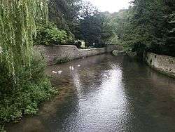
Ablington is a village in the county of Gloucestershire, England.[1] It is located in the Coln Valley and is part of the Bibury civil parish, 6 miles (9.7 km) north-east of Cirencester. Ablington is in the Cotswolds which has been designated by Natural England as an Area of Outstanding Natural Beauty (AONB).[2]
Ablington Manor is a Grade I listed building.[3]
References
- ↑ Ordnance Survey: Landranger map sheet 163 Cheltenham & Cirencester (Stow-on-the-Wold) (Map). Ordnance Survey. 2012. ISBN 9780319229125.
- ↑ "The Cotswolds Area of Outstanding Natural Beauty". www.landscapesforlife.org.uk. Retrieved 27 January 2016.
- ↑ Historic England. "Ablington Manor (Grade I) (1341833)". National Heritage List for England. Retrieved 28 October 2015.
External links
![]() Media related to Ablington, Gloucestershire at Wikimedia Commons
Media related to Ablington, Gloucestershire at Wikimedia Commons
This article is issued from Wikipedia - version of the 10/2/2016. The text is available under the Creative Commons Attribution/Share Alike but additional terms may apply for the media files.