Abington, South Lanarkshire
| Abington | |
 Abington Main Street |
|
 Clyde Bridges near Abington |
|
 Abington |
|
| Population | 200 [1] (2011 Census) |
|---|---|
| OS grid reference | NS931234 |
| Council area | South Lanarkshire |
| Lieutenancy area | Lanarkshire |
| Country | Scotland |
| Sovereign state | United Kingdom |
| Post town | BIGGAR |
| Postcode district | ML12 |
| Dialling code | 01864 |
| Police | Scottish |
| Fire | Scottish |
| Ambulance | Scottish |
| EU Parliament | Scotland |
| UK Parliament | Dumfriesshire, Clydesdale and Tweeddale |
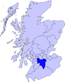
| Scottish Parliament | Clydesdale |
Coordinates: 55°29′37″N 3°41′14″W / 55.49365°N 3.68723°W
Abington is a village in the Scottish council region of South Lanarkshire, close to the M74 motorway, marking the point where it changes name to the A74(M), following the upgrade of the former A74 road. The West Coast Main Line between Glasgow and London also emerges from the Clyde Valley at this point and begins its ascent up Beattock Summit, alongside the motorway. Abington was at one time served by a station on the railway, but this was closed as a result of the Beeching cuts of the 1960s.
There is a post office in the village, as well the Upper Clyde Parish Church building.[2]
The village gives its name to the Abington services, which lies about one mile north.
See also
References
- ↑ "Scotland Census". Scotland's Census. Retrieved 19 December 2015.
- ↑ "Upper Clyde Parish Church". Upper Clyde Parish Church. Retrieved 19 December 2015.
External links
| Wikimedia Commons has media related to Abington, South Lanarkshire. |
- Its entry in the Gazetteer for Scotland
- Map sources for Abington, South Lanarkshire
This article is issued from Wikipedia - version of the 9/29/2016. The text is available under the Creative Commons Attribution/Share Alike but additional terms may apply for the media files.