Abererch
| Abererch | |
| Welsh: Aber-erch | |
 Abererch |
|
 Abererch |
|
| Population | 1,354 (Ward 2011)[1] |
|---|---|
| OS grid reference | SH395365 |
| Community | Llannor |
| Principal area | Gwynedd |
| Ceremonial county | Gwynedd |
| Country | Wales |
| Sovereign state | United Kingdom |
| Post town | PWLLHELI |
| Postcode district | LL53 |
| Dialling code | 01758 |
| Police | North Wales |
| Fire | North Wales |
| Ambulance | Welsh |
| EU Parliament | Wales |
| UK Parliament | Dwyfor Meirionnydd |
| Welsh Assembly | Dwyfor Meirionnydd |
Coordinates: 52°54′07″N 4°23′10″W / 52.902°N 4.386°W
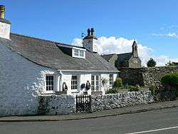
Abererch (Welsh for "Mouth of the Erch") is a small village and former civil parish on the Llŷn Peninsula in the Welsh county of Gwynedd. The village lies approximately 1 mile (1.6 km) east of Pwllheli. A river, the Afon Erch runs through the village.
The parish was abolished in 1934 and incorporated into that of Llannor, now the community of Llannor.[2] It is a mostly Welsh-speaking village.[3]

There is a primary school, playschool, and a railway station. The church of St Cawrdaf is a grade I listed building.[4]
Abererch has a beach which is between Pwllheli and Penychain (Haven Holiday Park). Parking for the beach is near the railway station. From the beach you have a view of Harlech Castle in the east all the way down to Tywyn (on a clearer day even further south) and to the west Pwllheli and the St Tudwals. Access to the beach is through a footpath next the caravan and camp-site. This beach is ideal for days when the wind is from the north or north west due to the sheltered bay.
References
| Wikimedia Commons has media related to Abererch. |
- ↑ "Ward population 2011". Retrieved 14 May 2015.
- ↑ http://www.visionofbritain.org.uk/relationships.jsp?u_id=10413965 A Vision of Britain Through Time : Abererch Civil Parish Retrieved 12 January 2010
- ↑ "2001 Census - Electoral Division Level Language Data" (XLS). Retrieved 25 November 2010.
- ↑ "Church of St Cawrdaf, Llannor". British Listed Buildings. Retrieved 4 January 2014.
