A Sầu Valley
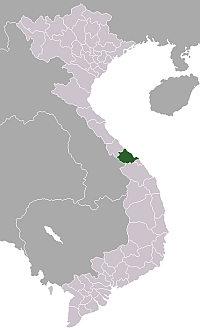
The A Shau Valley (Vietnamese: thung lũng A Sầu) is a valley in Vietnam's Thừa Thiên–Huế Province, west of the coastal city of Huế, along the border of Laos. The valley runs north and south for twenty-five miles and is a mile-wide flat bottomland covered with tall elephant grass, flanked by two strings of densely forested mountains that vary from three to six thousand feet. A Shau Valley was one of the key entry points into South Vietnam for men and materiel brought along the Ho Chi Minh Trail by the Communist North Vietnamese Army and was the scene of heavy fighting, especially against American soldiers, during the Vietnam War.[1][2] The A Shau Valley is bisected lengthwise by Route 548, a hard-crusted dirt road.[3]
See also
References
External links
| Wikimedia Commons has media related to A Shau Valley. |
Coordinates: 16°15′33.5″N 107°12′45″E / 16.259306°N 107.21250°E