A4059 road
| |
|---|---|
|
The A4059 passes through the Brecon Beacons | |
| Route information | |
| Length: | 9.5 mi (15.3 km) |
| Major junctions | |
| North end: | A470, Beacons Reservoir |
|
| |
| South end: | A470, Abercynon |
| Location | |
| Primary destinations: |
Hirwaun Aberdare Mountain Ash Abercynon |
| Road network | |

The A4059 road is a single-carriageway north-south road that runs between the A470 at Brecon Beacons National Park and the A470 at Abercynon.
Route
The road can be thought of as an alternative, but slightly longer route than the A470, the road on which both its termini are. It is a road with two parts of contrasting character, the northern half crossing through the wild rural Brecon Beacons while the southern half is at a lower elevation and is urban in nature.[1]
Southbound, the A4059 begins by turning right off the A470 to the south of Storey Arms, just after passing the Beacons Reservoir. The road crosses the top of the reservoir's dam before climbing away from the trees and onto exposed moor land to the west of the A470. Thereafter the A4059 climbs to a height of 450 metres (1,480 ft), following the River Taff 100 m below. At this point along the road, the A470 can be clearly seen in the valley below. As the A4059 continues through the Brecon Beacons, the vegetation is limited to coarse grass, and there are plenty of sheep. Leaving the park after passing through the small village of Penderyn, the road descends into Hirwaun, the first major destination on the southbound A4059. For a short segment past Hirwaun, the A4059 is synonymous with the A465. When the road leaves Hirwaun and the A465, it then turns southeast and follows the Cynon River, passing through Aberdare and Mountain Ash, although most of this urban stretch now runs on a new relief road, so avoiding the centres of the towns. Eventually, the A4059 reaches its southern terminus of Abercynon and rejoins the A470.[2][3]
References
- ↑ "A4059". Sabre. Retrieved 4 April 2016.
- ↑ A4059 (Brecon Beacons - Brecon to Hirwaun) from ruralroads.co.uk
- ↑ Google Maps: Penderyn to Cilfynydd
Transport in Powys | |||||||||||
|---|---|---|---|---|---|---|---|---|---|---|---|
| Road | 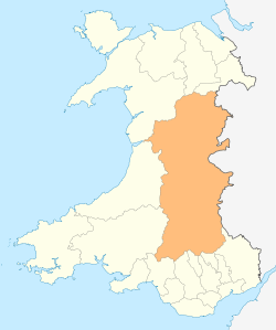 | ||||||||||
| Footpaths | |||||||||||
| Cycle routes | |||||||||||
| Railway stations |
| ||||||||||