74th meridian west

74°
74th meridian west

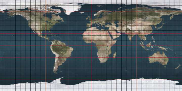
The meridian 74° west of Greenwich is a line of longitude that extends from the North Pole across the Arctic Ocean, North America, the Atlantic Ocean, the Caribbean Sea, South America, the Pacific Ocean, the Southern Ocean, and Antarctica to the South Pole.

In the United States, the meridian passes through New York City.

In Antarctica, the meridian defines the western limit of the Argentinian territorial claim, and passes through the Chilean and British claims – the three claims overlap.

The 74th meridian west forms a great circle with the 106th meridian east.

From Pole to Pole

Starting at the North Pole and heading south to the South Pole, the 74th meridian west passes through:

Co-ordinates Country, territory or sea Notes
90°0′N 74°0′W / 90.000°N 74.000°W / 90.000; -74.000 (Arctic Ocean) Arctic Ocean
82°56′N 74°0′W / 82.933°N 74.000°W / 82.933; -74.000 (Canada)  Canada NunavutEllesmere Island
79°27′N 74°0′W / 79.450°N 74.000°W / 79.450; -74.000 (Nares Strait) Nares Strait
78°0′N 74°0′W / 78.000°N 74.000°W / 78.000; -74.000 (Baffin Bay) Baffin Bay
71°44′N 74°0′W / 71.733°N 74.000°W / 71.733; -74.000 (Canada)  Canada NunavutBaffin Island
68°30′N 74°0′W / 68.500°N 74.000°W / 68.500; -74.000 (Foxe Basin) Foxe Basin
68°3′N 74°0′W / 68.050°N 74.000°W / 68.050; -74.000 (Canada)  Canada NunavutAir Force Island
67°47′N 74°0′W / 67.783°N 74.000°W / 67.783; -74.000 (Foxe Basin) Foxe Basin
66°19′N 74°0′W / 66.317°N 74.000°W / 66.317; -74.000 (Canada)  Canada NunavutBaffin Island
65°50′N 74°0′W / 65.833°N 74.000°W / 65.833; -74.000 (Foxe Basin) Foxe Basin
65°30′N 74°0′W / 65.500°N 74.000°W / 65.500; -74.000 (Canada)  Canada NunavutBaffin Island
64°17′N 74°0′W / 64.283°N 74.000°W / 64.283; -74.000 (Hudson Strait) Hudson Strait
62°40′N 74°0′W / 62.667°N 74.000°W / 62.667; -74.000 (Canada)  Canada NunavutCharles Island
62°24′N 74°0′W / 62.400°N 74.000°W / 62.400; -74.000 (Hudson Strait) Hudson Strait
62°22′N 74°0′W / 62.367°N 74.000°W / 62.367; -74.000 (Canada)  Canada Quebec
45°0′N 74°0′W / 45.000°N 74.000°W / 45.000; -74.000 (United States)  United States New York
New Jersey — from 41°2′N 74°0′W / 41.033°N 74.000°W / 41.033; -74.000 (New Jersey)
New York — Manhattan Island and Long Island, from 40°47′N 74°0′W / 40.783°N 74.000°W / 40.783; -74.000 (New York)
40°34′N 74°0′W / 40.567°N 74.000°W / 40.567; -74.000 (Atlantic Ocean) Atlantic Ocean Lower New York Bay
40°28′N 74°0′W / 40.467°N 74.000°W / 40.467; -74.000 (United States)  United States New Jersey
40°13′N 74°0′W / 40.217°N 74.000°W / 40.217; -74.000 (Atlantic Ocean) Atlantic Ocean Passing just east of Crooked Island,  Bahamas (at 23°43′N 74°1′W / 23.717°N 74.017°W / 23.717; -74.017 (Crooked Island))
22°41′N 74°0′W / 22.683°N 74.000°W / 22.683; -74.000 (Bahamas)  Bahamas Island of Acklins
22°35′N 74°0′W / 22.583°N 74.000°W / 22.583; -74.000 (Atlantic Ocean) Atlantic Ocean Bight of Acklins
22°25′N 74°0′W / 22.417°N 74.000°W / 22.417; -74.000 (Bahamas)  Bahamas Island of Acklins
22°20′N 74°0′W / 22.333°N 74.000°W / 22.333; -74.000 (Atlantic Ocean) Atlantic Ocean Passing just east of  Cuba (at 20°12′N 74°8′W / 20.200°N 74.133°W / 20.200; -74.133 (Cuba))
20°0′N 74°0′W / 20.000°N 74.000°W / 20.000; -74.000 (Caribbean Sea) Caribbean Sea
18°36′N 74°0′W / 18.600°N 74.000°W / 18.600; -74.000 (Haiti)  Haiti Tiburon Peninsula, island of Hispaniola
18°10′N 74°0′W / 18.167°N 74.000°W / 18.167; -74.000 (Caribbean Sea) Caribbean Sea
11°21′N 74°0′W / 11.350°N 74.000°W / 11.350; -74.000 (Colombia)  Colombia Passing just east of Bogotá (at 4°37′N 74°5′W / 4.617°N 74.083°W / 4.617; -74.083 (Bogotá))
1°7′S 74°0′W / 1.117°S 74.000°W / -1.117; -74.000 (Peru)  Peru
16°2′S 74°0′W / 16.033°S 74.000°W / -16.033; -74.000 (Pacific Ocean) Pacific Ocean
41°47′S 74°0′W / 41.783°S 74.000°W / -41.783; -74.000 (Chile)  Chile Chiloé Island
43°24′S 74°0′W / 43.400°S 74.000°W / -43.400; -74.000 (Gulf of Corcovado) Gulf of Corcovado
43°47′S 74°0′W / 43.783°S 74.000°W / -43.783; -74.000 (Chile)  Chile Chonos Archipelago, Taitao Peninsula (mainland), Merino Jarpa Island, mainland, and several islands in the Patagonic Archipelago
52°42′S 74°0′W / 52.700°S 74.000°W / -52.700; -74.000 (Straits of Magellan) Straits of Magellan
52°58′S 74°0′W / 52.967°S 74.000°W / -52.967; -74.000 (Chile)  Chile Desolación Island
53°11′S 74°0′W / 53.183°S 74.000°W / -53.183; -74.000 (Pacific Ocean) Pacific Ocean
60°0′S 74°0′W / 60.000°S 74.000°W / -60.000; -74.000 (Southern Ocean) Southern Ocean
69°39′S 74°0′W / 69.650°S 74.000°W / -69.650; -74.000 (Antarctica) Antarctica The western limit of Argentine Antarctica, claimed by  Argentina, and passing through Antártica Chilena Province, claimed by  Chile, and British Antarctic Territory, claimed by  United Kingdom

See also

This article is issued from Wikipedia - version of the 10/25/2016. The text is available under the Creative Commons Attribution/Share Alike but additional terms may apply for the media files.