5th parallel north

5th parallel north

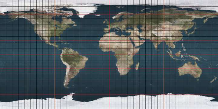
The 5th parallel north is a circle of latitude that is 5 degrees north of the Earth's equatorial plane. It crosses the Atlantic Ocean, Africa, the Indian Ocean, Southeast Asia, the Pacific Ocean and South America.

The Pacific Ocean is at its widest (approximately 19,300 km) on this parallel.[1]

Around the world

Starting at the Prime Meridian and heading eastwards, the parallel 5° north passes through:

Co-ordinates Country, territory or sea Notes
5°0′N 0°0′E / 5.000°N 0.000°E / 5.000; 0.000 (Prime Meridian) Atlantic Ocean Bight of Benin
5°0′N 5°26′E / 5.000°N 5.433°E / 5.000; 5.433 (Nigeria)  Nigeria
5°0′N 8°41′E / 5.000°N 8.683°E / 5.000; 8.683 (Cameroon)  Cameroon
5°0′N 14°41′E / 5.000°N 14.683°E / 5.000; 14.683 (Central African Republic)  Central African Republic
5°0′N 19°14′E / 5.000°N 19.233°E / 5.000; 19.233 (Democratic Republic of the Congo)  Democratic Republic of the Congo
5°0′N 19°53′E / 5.000°N 19.883°E / 5.000; 19.883 (Central African Republic)  Central African Republic
5°0′N 24°18′E / 5.000°N 24.300°E / 5.000; 24.300 (Democratic Republic of the Congo)  Democratic Republic of the Congo
5°0′N 24°38′E / 5.000°N 24.633°E / 5.000; 24.633 (Central African Republic)  Central African Republic
5°0′N 25°8′E / 5.000°N 25.133°E / 5.000; 25.133 (Democratic Republic of the Congo)  Democratic Republic of the Congo
5°0′N 27°29′E / 5.000°N 27.483°E / 5.000; 27.483 (South Sudan)  South Sudan
5°0′N 35°49′E / 5.000°N 35.817°E / 5.000; 35.817 (Ethiopia)  Ethiopia
5°0′N 45°3′E / 5.000°N 45.050°E / 5.000; 45.050 (Somalia)  Somalia
5°0′N 48°16′E / 5.000°N 48.267°E / 5.000; 48.267 (Indian Ocean) Indian Ocean Passing between Southern Maalhosmadulhu Atoll and Horsburgh Atoll,  Maldives
Passing just north of the island of Kaashidhoo,  Maldives
5°0′N 95°21′E / 5.000°N 95.350°E / 5.000; 95.350 (Indonesia)  Indonesia Island of Sumatra
5°0′N 97°44′E / 5.000°N 97.733°E / 5.000; 97.733 (Strait of Malacca) Strait of Malacca
5°0′N 100°24′E / 5.000°N 100.400°E / 5.000; 100.400 (Malaysia)  Malaysia Malacca Strait
5°0′N 103°19′E / 5.000°N 103.317°E / 5.000; 103.317 (South China Sea) South China Sea
5°0′N 114°55′E / 5.000°N 114.917°E / 5.000; 114.917 (Brunei)  Brunei On the island of Borneo
5°0′N 115°7′E / 5.000°N 115.117°E / 5.000; 115.117 (Brunei Bay) Brunei Bay
5°0′N 115°27′E / 5.000°N 115.450°E / 5.000; 115.450 (Malaysia)  Malaysia Sabah, island of Borneo
5°0′N 118°52′E / 5.000°N 118.867°E / 5.000; 118.867 (Celebes Sea) Celebes Sea Passing north of the Sibutu islands,  Philippines
Passing between the islands of Bongao and Simunul,  Philippines
5°0′N 120°0′E / 5.000°N 120.000°E / 5.000; 120.000 (Philippines)  Philippines Island of Bilatan
5°0′N 120°1′E / 5.000°N 120.017°E / 5.000; 120.017 (Celebes Sea) Celebes Sea Passing just south of the islands of Banaran and Mantabuan,  Philippines
5°0′N 125°23′E / 5.000°N 125.383°E / 5.000; 125.383 (Pacific Ocean) Pacific Ocean Passing between the islands of Sonsorol and Pulo Anna,  Palau
Passing just south of Satawan and Kosrae atolls,  Federated States of Micronesia
Passing between Namdrik and Ebon atolls,  Marshall Islands
Passing just north of Teraina atoll,  Kiribati
Passing just south of Cocos Island,  Costa Rica
5°0′N 77°22′W / 5.000°N 77.367°W / 5.000; -77.367 (Colombia)  Colombia
5°0′N 67°48′W / 5.000°N 67.800°W / 5.000; -67.800 (Venezuela)  Venezuela
5°0′N 60°35′W / 5.000°N 60.583°W / 5.000; -60.583 (Brazil)  Brazil Roraima
5°0′N 59°59′W / 5.000°N 59.983°W / 5.000; -59.983 (Area disputed between Guyana and Venezuela) Disputed area Controlled by  Guyana, claimed by  Venezuela
5°0′N 58°50′W / 5.000°N 58.833°W / 5.000; -58.833 (Guyana)  Guyana
5°0′N 57°42′W / 5.000°N 57.700°W / 5.000; -57.700 (Suriname)  Suriname For about 7 km
5°0′N 57°38′W / 5.000°N 57.633°W / 5.000; -57.633 (Guyana)  Guyana For about 6 km
5°0′N 57°34′W / 5.000°N 57.567°W / 5.000; -57.567 (Suriname)  Suriname For about 8 km
5°0′N 57°30′W / 5.000°N 57.500°W / 5.000; -57.500 (Guyana)  Guyana For about 12 km
5°0′N 57°24′W / 5.000°N 57.400°W / 5.000; -57.400 (Suriname)  Suriname
5°0′N 54°26′W / 5.000°N 54.433°W / 5.000; -54.433 (France)  France French Guiana
5°0′N 52°25′W / 5.000°N 52.417°W / 5.000; -52.417 (Atlantic Ocean) Atlantic Ocean
5°0′N 9°2′W / 5.000°N 9.033°W / 5.000; -9.033 (Liberia)  Liberia
5°0′N 7°32′W / 5.000°N 7.533°W / 5.000; -7.533 (Côte d'Ivoire)  Ivory Coast
5°0′N 5°56′W / 5.000°N 5.933°W / 5.000; -5.933 (Atlantic Ocean) Atlantic Ocean Gulf of Guinea
5°0′N 2°40′W / 5.000°N 2.667°W / 5.000; -2.667 (Ghana)  Ghana
5°0′N 1°38′W / 5.000°N 1.633°W / 5.000; -1.633 (Atlantic Ocean) Atlantic Ocean Bight of Benin

See also

References

  1. "Pacific Ocean". Encyclopaedia Britannica. Retrieved 27 August 2012.
This article is issued from Wikipedia - version of the 9/8/2016. The text is available under the Creative Commons Attribution/Share Alike but additional terms may apply for the media files.