28th parallel north

28°
28th parallel north
In Mexico the parallel defines the border between the states of Baja California and Baja California Sur.

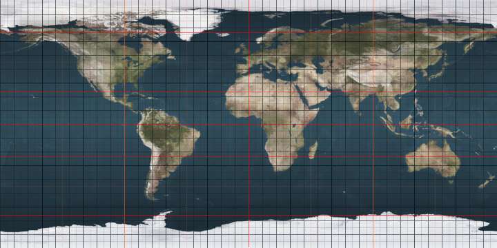
The 28th parallel north is a circle of latitude that is 28 degrees north of the Earth's equatorial plane. It crosses Africa, Asia, the Pacific Ocean, North America and the Atlantic Ocean.

In Mexico the parallel defines the border between the states of Baja California and Baja California Sur.

This parallel also passes through Mount Everest, the tallest mountain on Earth, passing just north of its summit.

At this latitude the sun is visible for 13 hours, 55 minutes during the summer solstice and 10 hours, 22 minutes during the winter solstice.[1]

Around the world

Starting at the Prime Meridian and heading eastwards, the parallel 28° north passes through:

Co-ordinates Country, territory or sea Notes
28°0′N 0°0′E / 28.000°N 0.000°E / 28.000; 0.000 (Prime Meridian)  Algeria
28°0′N 9°55′E / 28.000°N 9.917°E / 28.000; 9.917 (Libya)  Libya
28°0′N 25°0′E / 28.000°N 25.000°E / 28.000; 25.000 (Egypt)  Egypt
28°0′N 33°27′E / 28.000°N 33.450°E / 28.000; 33.450 (Red Sea) Red Sea Gulf of Suez
28°0′N 33°48′E / 28.000°N 33.800°E / 28.000; 33.800 (Egypt)  Egypt Sinai Peninsula
28°0′N 34°26′E / 28.000°N 34.433°E / 28.000; 34.433 (Red Sea) Red Sea Straits of Tiran
28°0′N 34°30′E / 28.000°N 34.500°E / 28.000; 34.500 (Saudi Arabia)  Saudi Arabia Island of Tiran
28°0′N 34°33′E / 28.000°N 34.550°E / 28.000; 34.550 (Red Sea) Red Sea
28°0′N 35°10′E / 28.000°N 35.167°E / 28.000; 35.167 (Saudi Arabia)  Saudi Arabia
28°0′N 48°46′E / 28.000°N 48.767°E / 28.000; 48.767 (Persian Gulf) Persian Gulf
28°0′N 51°20′E / 28.000°N 51.333°E / 28.000; 51.333 (Iran)  Iran
28°0′N 62°47′E / 28.000°N 62.783°E / 28.000; 62.783 (Pakistan)  Pakistan Balochistan
Sindh
Punjab
28°0′N 70°21′E / 28.000°N 70.350°E / 28.000; 70.350 (India)  India Rajasthan
28°0′N 70°35′E / 28.000°N 70.583°E / 28.000; 70.583 (Pakistan)  Pakistan Punjab
28°0′N 71°54′E / 28.000°N 71.900°E / 28.000; 71.900 (India)  India Rajasthan
Haryana
Rajasthan
Haryana
Uttar Pradesh
28°0′N 81°38′E / 28.000°N 81.633°E / 28.000; 81.633 (Nepal)    Nepal
28°0′N 85°57′E / 28.000°N 85.950°E / 28.000; 85.950 (China)  People's Republic of China Tibet - for about 14 km
28°0′N 86°5′E / 28.000°N 86.083°E / 28.000; 86.083 (Nepal)    Nepal For about 11 km
28°0′N 86°12′E / 28.000°N 86.200°E / 28.000; 86.200 (China)  People's Republic of China Tibet - for about 30 km
28°0′N 86°30′E / 28.000°N 86.500°E / 28.000; 86.500 (Nepal)    Nepal Mount Everest lies on the parallel as it crosses from Nepal to China
28°0′N 86°53′E / 28.000°N 86.883°E / 28.000; 86.883 (China)  People's Republic of China Tibet
28°0′N 88°25′E / 28.000°N 88.417°E / 28.000; 88.417 (India)  India Sikkim
28°0′N 88°50′E / 28.000°N 88.833°E / 28.000; 88.833 (China)  People's Republic of China Tibet
28°0′N 88°27′E / 28.000°N 88.450°E / 28.000; 88.450 (Bhutan)  Bhutan
28°0′N 91°0′E / 28.000°N 91.000°E / 28.000; 91.000 (China)  People's Republic of China Tibet - for about 15 km
28°0′N 91°9′E / 28.000°N 91.150°E / 28.000; 91.150 (Bhutan)  Bhutan
28°0′N 91°27′E / 28.000°N 91.450°E / 28.000; 91.450 (China)  People's Republic of China Tibet
28°0′N 92°43′E / 28.000°N 92.717°E / 28.000; 92.717 (India)  India Arunachal Pradesh - partly claimed by  People's Republic of China
28°0′N 97°23′E / 28.000°N 97.383°E / 28.000; 97.383 (Myanmar)  Myanmar (Burma)
28°0′N 98°8′E / 28.000°N 98.133°E / 28.000; 98.133 (China)  People's Republic of China Yunnan
Sichuan
Yunnan
Sichuan
Yunnan
Sichuan
Guizhou
Hunan
Jiangxi
Fujian
Zhejiang
28°0′N 120°57′E / 28.000°N 120.950°E / 28.000; 120.950 (East China Sea) East China Sea
28°0′N 129°5′E / 28.000°N 129.083°E / 28.000; 129.083 (Pacific Ocean) Pacific Ocean Passing through the Amami Islands,  Japan
Passing just north of the Bonin Islands,  Japan
Passing just south of Midway Atoll,  United States Minor Outlying Islands
Passing just north of Pearl and Hermes Atoll, Hawaii,  United States
Passing just south of Cedros Island,  Mexico
28°0′N 114°12′W / 28.000°N 114.200°W / 28.000; -114.200 (Mexico)  Mexico Baja California/Baja California Sur border
28°0′N 112°46′W / 28.000°N 112.767°W / 28.000; -112.767 (Gulf of California) Gulf of California
28°0′N 111°10′W / 28.000°N 111.167°W / 28.000; -111.167 (Mexico)  Mexico
28°0′N 100°0′W / 28.000°N 100.000°W / 28.000; -100.000 (United States)  United States Texas - mainland and San José Island
28°0′N 96°54′W / 28.000°N 96.900°W / 28.000; -96.900 (Gulf of Mexico) Gulf of Mexico
28°0′N 82°50′W / 28.000°N 82.833°W / 28.000; -82.833 (United States)  United States Florida - island of Clearwater Beach and the mainland
28°0′N 80°31′W / 28.000°N 80.517°W / 28.000; -80.517 (Atlantic Ocean) Atlantic Ocean Passing just south of the island of La Gomera,  Spain
28°0′N 16°42′W / 28.000°N 16.700°W / 28.000; -16.700 (Spain)  Spain Island of Tenerife
28°0′N 16°38′W / 28.000°N 16.633°W / 28.000; -16.633 (Atlantic Ocean) Atlantic Ocean
28°0′N 15°49′W / 28.000°N 15.817°W / 28.000; -15.817 (Spain)  Spain Island of Gran Canaria
28°0′N 15°22′W / 28.000°N 15.367°W / 28.000; -15.367 (Atlantic Ocean) Atlantic Ocean Passing just south of the island of Fuerteventura,  Spain
28°0′N 12°32′W / 28.000°N 12.533°W / 28.000; -12.533 (Morocco)  Morocco
28°0′N 8°40′W / 28.000°N 8.667°W / 28.000; -8.667 (Algeria)  Algeria

28th parallel north in popular culture

See also

References

This article is issued from Wikipedia - version of the 5/3/2016. The text is available under the Creative Commons Attribution/Share Alike but additional terms may apply for the media files.