2006 Kuril Islands earthquake
 | |
| Date | November 15, 2006 |
|---|---|
| Origin time | 11:14:16 UTC [1] |
| Magnitude | 8.3 Mw [1] |
| Depth | 31 km (19 mi) [1] |
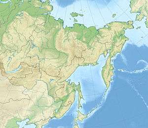
| Epicenter | 46°31′N 153°19′E / 46.52°N 153.32°ECoordinates: 46°31′N 153°19′E / 46.52°N 153.32°E [1] |
| Type | Megathrust |
| Areas affected | Japan, Russia |
| Max. intensity | IV (Light) [2] |
| Casualties | 1 injured [3] |
The 2006 Kuril Islands earthquake occurred on November 15 at 8:14:16 pm JST with a moment magnitude of 8.3 and a maximum Mercalli intensity of IV (Light). This megathrust earthquake was the largest event in the central Kuril Islands since 1915 and generated a small tsunami that affected the northern Japanese coast. The tsunami crossed the Pacific Ocean and damaged the harbor at Crescent City, California. Post-tsunami surveys indicate that the local tsunami in the central Kuril Islands reached runup of 15 metres (49 ft) or more.[4]
Tsunami
At about 11:45 UTC, tsunami warnings were issued in Japan for the north coasts of Hokkaidō and Honshū, and a number of towns in this area were very quickly evacuated. Tsunami warnings, advisories and watches were also issued for the coastal areas of Alaska, Hawaii, parts of British Columbia, Washington, Oregon, and California. JMA initially estimated tsunami waves to be as tall as 2 metres when it hit the Japanese northern and eastern coasts, but it turned out to be merely 40 centimetres when it reached Hanasaki Ko, Nemuro, Nemuro, Hokkaidō at 9:29 pm local time. The tsunami also hit the rest of Hokkaidō and Tōhoku Region. The tallest wave recorded in Japan was at Tsubota (坪田), Miyakejima (三宅島) in the Izu Shotō of the Tokyo To, at 84 centimetres. Tsunami also hit as far as Anami in Kagoshima Prefecture and Naha in Okinawa Prefecture, and reached the Hawaiian and California coasts. A 176-centimetre wave in the Crescent City, California, harbor caused an estimated $10 million in damage to the docks there.[5] The United States authorities had issued warnings for the Russian Far East, Japan, Wake Island and Midway Atoll.
The nearfield tsunami struck islands with no current inhabitants. However, geologists and archaeologists had visited these islands the previous summer, and returned in the summers of 2007 and 2008.[6][7][8] Because there were two central Kurils tsunamis in the winter of 2006/2007 (see 2007 Kuril Islands earthquake), the specific effects of each tsunami are difficult to determine; evidence is that the 2006 tsunami was the larger on all islands in the Kurils except Matua and parts of Rasshua.[9]
See also
References
- 1 2 3 4 ISC (2015), ISC-GEM Global Instrumental Earthquake Catalogue (1900–2009), Version 2.0, International Seismological Centre
- ↑ USGS. "M8.3 - Kuril Islands". United States Geological Survey.
- ↑ USGS (September 4, 2009), PAGER-CAT Earthquake Catalog, Version 2008_06.1, United States Geological Survey
- ↑ MacInnes, B.T., Bourgeois, J., Pinegina, T.K., Kravchunovskays, E., 2009. Tsunami geomorphology: erosion and deposition from the 15 November 2006 Kuril Island tsunami: Geology, v. 37, p. 995–998.
- ↑ Central Kuril Island Tsunami in Crescent City, California University of Southern California
- ↑ MacInnes et al., 2009, see above.
- ↑ Bourgeois, J. and MacInnes, B.T., 2010. Tsunami boulder transport and other dramatic effects of the 15 November 2006 central Kuril Islands tsunami on the island of Matua: Zeitschrift für Geomorphologie, Supplementbände Volume 54, Supplementary Issue 3 (2010), p. 175–195 doi:10.1127/0372-8854/2010/0054S3-0024.
- ↑ MacInnes, B.T., Pinegina, T.K., Bourgeois, J., Razhegaeva, N.G., Kaistrenko, V.M., and Kravchunovskaya, E.A., 2009, Field survey and geological effects of the 15 November 2006 Kuril tsunami in the middle Kuril Islands, Pure and Applied Geophysics v. 166, doi:10.1007/s00024-008-0428-3.
- ↑ MacInnes, B.T., 2010 Ph.D. dissertation, University of Washington.
Sources
- Lay, T.; Kanamori, H.; Ammon, C. J.; Hutko, A. R.; Furlong, K.; Rivera, L. (2009), "The 2006–2007 Kuril Islands great earthquake sequence" (PDF), Journal of Geophysical Research, American Geophysical Union, 114 (B11), Bibcode:2009JGRB..11411308L, doi:10.1029/2008JB006280
- Rabinovich, A. B.; Lobkovsky, L. I.; Fine, I. V.; Thomson, R. E.; Ivelskaya, T. N.; Kulikov1, E. A. (2008), "Near-source observations and modeling of the Kuril Islands tsunamis of 15 November 2006 and 13 January 2007" (PDF), Advances in Geosciences, European Geosciences Union (14): 105–116, doi:10.5194/adgeo-14-105-2008
External links
| Wikinews has related news: Japan and Russia on tsunami alert |
- Japan's false alarm showcases tsunami alert system – Christian Science Monitor
- Small tsunamis hit northern Japan – BBC News
- Central Kuril Island Tsunami in Crescent City, California (11/15/2006) – University of Southern California
- Small tsunami waves hit Japan after earthquake – Associated Press
- Global Surge of Great Earthquakes—What We Are Learning From Them – IRIS Consortium