2000 New Ireland earthquakes
 | |
| Date | November 16, 2000 |
|---|---|
| Magnitude | 8.0 Mw |
| Depth | 33 kilometres (21 mi) |
| Epicenter | 3°58′48″S 152°10′08″E / 3.980°S 152.169°ECoordinates: 3°58′48″S 152°10′08″E / 3.980°S 152.169°E |
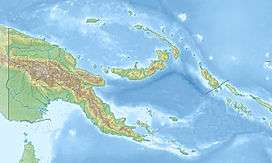
| Areas affected | Papua New Guinea |
| Tsunami | Yes |
| Casualties | 2 killed |
The 2000 New Ireland earthquakes occurred off the coast of New Ireland Province, Papua New Guinea on November 16 and 17.
The mainshock was a magnitude 8.0 Mw [1] strike-slip event that occurred on November 16 at 04:54 UTC, and ruptured a section of the transform boundary between the north and south Bismarck plates.[2] A 7.8 magnitude [3] thrust earthquake followed at 07:42 UTC with its epicenter 175 km south of the first earthquake at the southern end of its rupture zone at 5°29′46″S 151°46′52″E / 5.496°S 151.781°E. Another 7.8 magnitude [4] thrust event occurred on November 17 at 21:01 UTC, this time occurring 174 km south west of the initial event at 5°13′59″S 153°06′07″E / 5.233°S 153.102°E in eastern New Britain.[5]
This sequence of earthquakes killed two people, and triggered landslides in southern New Ireland. Damage caused by the events and the following tsunami occurred in New Britain, Duke of York Island, western Bougainville and Buka.[6] The magnitude 8.0 event was the largest earthquake to occur in the world during 2000.[7]
See also
References
- ↑ Magnitude 8.0 NEW IRELAND REGION, P.N.G. United States Geological Survey
- ↑ The New Ireland earthquakes of November 16, 2000, and the tsunami generated by the earthquake
- ↑ Magnitude 7.8 NEW IRELAND REGION, P.N.G. United States Geological Survey
- ↑ Magnitude 7.8 NEW BRITAIN REGION, P.N.G. United States Geological Survey
- ↑ Triggering of tsunamigenic aftershocks from large strike-slip earthquakes: Analysis of the November 2000 New Ireland earthquake sequence
- ↑ Significant Earthquakes of the World 2000
- ↑ Magnitude 7 and Greater Earthquakes in 2000