1917 Bali earthquake
 | |
| Date | January 20, 1917 |
|---|---|
| Magnitude | 6.6 Ms[1] |
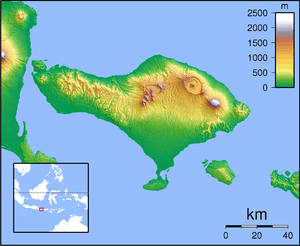
| Epicenter | 8°18′S 115°00′E / 8.3°S 115.0°ECoordinates: 8°18′S 115°00′E / 8.3°S 115.0°E[2] |
| Areas affected | Dutch East Indies, Bali |
| Max. intensity | IX (Violent) |
| Tsunami | Minor |
| Landslides | Many |
| Foreshocks | Yes |
| Casualties | 1,500 |
The 1917 Bali earthquake occurred at 06:50 local time on 21 January (23:11 on 20 January UTC). It had an estimated magnitude of 6.6 on the surface wave magnitude scale and had a maximum perceived intensity of IX (Violent) on the Mercalli intensity scale. It caused widespread damage across Bali, particularly in the south of the island. It triggered many landslides, which caused 80% of the 1500 casualties.
Tectonic setting
The island of Bali forms part of the Sunda Arc, which formed above the convergent boundary where the Australian Plate is subducting beneath the Sunda Plate. The rate of convergence across the line of the Sunda–Java Trench is 7.5 cm per year. Eastwards from Bali, the Sunda Arc is also being thrust over the Bali and Flores back-arc basins on a series of south-dipping thrusts. Focal mechanisms for earthquakes near Bali are dominantly thrust sense on both the subduction interface and the system of thrust faults to the north.[3]
Earthquake
The earthquake was recorded by the Wiechert seismograph at Batavia (now Jakarta), which indicated an epicenter southeast of the island. There was a general decrease in the intensity of the shaking from the south of the island to the north. The earthquake was also felt on eastern Java and Sumbawa, and particularly strongly on Lombok. A small tsunami was observed on the southeastern coast of Bali, but caused no damage.[1]
Damage
The earthquake triggered many landslides. There were an estimated 1,500 casualties, of which 80% were a result of the landslides. 2,431 temples were destroyed or severely damaged,[4] including the Pura Ulun Danu Batur.[5]
See also
References
- 1 2 National Geophysical Data Center. "Significant Earthquake". Retrieved 10 November 2012.
- ↑ Utsu, T. "Catalog of Damaging Earthquakes in the World (Through 2009)". International Institute of Seismology and Earthquake Engineering. Retrieved 10 November 2012.
- ↑ McCaffrey, R.; Nabelek J. (1987). "Earthquakes, gravity, and the origin of the Bali Basin: an example of a nascent continental fold-and-thrust belt" (PDF). Journal of Geophysical Research. National Academy of Sciences. 92 (B1): 441–460. doi:10.1029/jb092ib01p00441. Retrieved 10 November 2012.
- ↑ Hooykaas, C. (1973). Religion in Bali. Iconography of Religions Section 13. 10. BRILL. p. 2. ISBN 9789004037977. Retrieved 11 November 2012.
- ↑ Lansing, J.S. (2012). Perfect Order: Recognizing Complexity in Bali. Princeton Studies in Complexity. Princeton University Press. p. 176. ISBN 9780691156262. Retrieved 11 November 2012.