1907 Kingston earthquake
 | |
 | |
| Date | January 14, 1907 |
|---|---|
| Magnitude | 6.5 Mw |
| Epicenter | 18°12′N 76°42′W / 18.20°N 76.7°WCoordinates: 18°12′N 76°42′W / 18.20°N 76.7°W[1] |
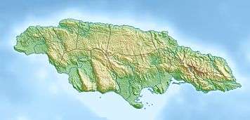
| Areas affected | Jamaica |
| Tsunami | yes |
| Casualties | 800–1,000 |
The 1907 Kingston earthquake which shook the capital of the island of Jamaica with a magnitude of 6.5 on the moment magnitude scale on Monday January 14, at about 3:30 pm local time (20:36 UTC), was considered by many writers of that time one of the world's deadliest earthquakes recorded in history.[2] Every building in Kingston was damaged by the earthquake and subsequent fires, which lasted for three hours before any efforts were made to check them, culminated in the death of 800 to 1,000 people, and left approximately 10,000 homeless and $25,000,000 in material damage.[2] Shortly after, a tsunami was reported on the north coast of Jamaica, with a maximum wave height of about 2 m (6–8 ft).[3]
Tectonic setting
Jamaica lies within a complex zone of faulting that forms the boundary between the Gonâve Microplate and the Caribbean Plate. To the east of the island the main fault is the Enriquillo–Plantain Garden fault zone while to the west the main structure is the Walton fault zone, both major sinistral (left lateral) strike-slip faults. The transfer of plate boundary displacement between these major fault zones takes place on a series of NW-SE trending faults, such as the Wagwater Belt. The overall tectonic setting is one of transpression at this restraining bend in the plate boundary.[4]
Damage
The greatest damage occurred at Kingston and at Buff Bay and Annotto Bay on the northern coast. Eighty-five percent of buildings in Kingston were destroyed by the shaking, which was followed by a fire that destroyed parts of the business and warehouse districts.[5] The Elder-Dempster passenger steamer Port Kingston, which was under repair in Kingston Harbour at the time, was threatened by fire on the nearby wharf. A rapid temporary repair allowed her to be moved to the unaffected railway wharf before the fire reached her.[6] A suspension bridge was destroyed at Port Maria.[1]
Characteristics
.jpg)
Earthquake
The main shock lasted for about 35 seconds after some minor initial tremors and was accompanied by a roaring sound. The intensity of the shaking grew quickly to a first and strongest climax. The intensity then lessened before again reaching a second weaker climax.[5] There were eighty aftershocks recorded up to 5 February, while the strongest of all was recorded on 23 February.
The epicenter of the earthquake is not well constrained. The only seismograph in Jamaica at the time was put out of action by the earthquake.[1] The rupture may have been on an eastward continuation of the South Coast Fault Zone, within the Wagwater Belt or in the Blue Mountains.[4] The greatest felt intensity was noted for areas built on unconsolidated sands and gravels. To the east of Kingston, along the Palisadoes, there were sandblows and surface faulting associated with areas of subsidence and flooding.[5]
Tsunami
After the earthquake tsunami were observed along much of the north coast of Jamaica at Hope Bay, Port Antonio, Orange Bay, Sheerness Bay, Saint Ann's Bay, Buff Bay, Port Maria and Annotto Bay; there were also some reports of waves along the south coast. Seiches were reported in Kingston harbour.[7] The level of the sea at Annotto Bay was reported to have initially dropped by more than 3 metres, as the sea withdrew a distance of about 80 m, before returning at a height of about 2 metres above normal, flooding the lower parts of the town.
Aftermath
The Port Kingston, the only passenger ship in Kingston Harbour, was used as a makeshift hospital, with improvised operating theatres in three parts of the ship and on the adjoining wharf. Kingston Public Hospital, despite loss of its water supply, continued to function throughout the following night.[8] Three United States warships, USS Missouri, USS Indiana and USS Whipple landed men and supplies on 17 January, although an offer of eight surgeons was rejected by the Governor.[6]
See also
References
- 1 2 3 NGDC. "Comments for the Significant Earthquake". Retrieved 27 August 2010.
- 1 2 J. F. Wilson Earthquakes and Volcanoes: Hot Springs, pg. 70, BiblioLife (2008), ISBN 0-554-56496-3
- ↑ "Today in Earthquake History". USGS. 14 January 2010. Retrieved 15 January 2010.
- 1 2 Mann, P.; Demets C. & Wiggins-Grandison M. (2007). "Toward a better understanding of the Late Neogene strike-slip restraining bend in Jamaica: geodetic, geological, and seismic constraints". In Cunningham W.D. & Mann P. Restraining bends, transpressional deformation and basement controls on development (PDF). Geological Society, London, Special Publications. 290. Geological Society, London. pp. 239–253. Retrieved 29 October 2010.
- 1 2 3 Brown, C.W. (May 1907). "The Jamaica earthquake". Popular Science: 385–403. Retrieved 2 November 2010.
- 1 2 Caine, R.H. (18 January 1907). "Saw Kingston's day of terror". The New York Times. Retrieved 3 November 2010.
- ↑ Maul, G.A. (2006). "The Case for an Atlantic tsunami warning system". In Mercado-Irizarry A. & Liu P.L.F. Caribbean tsunami hazard. World Scientific. p. 35. ISBN 978-981-256-535-8.
- ↑ Evans, A.J. (9 February 1907). "Experiences during the recent earthquake in Jamaica". British Medical Journal. 1 (2406): 348. doi:10.1136/bmj.1.2406.348. PMC 2356668
 . PMID 20763070.
External links
- 1907 Earthquake A pictorial guide to the 1907 Kingston earthquake.