16th parallel south

16°
16th parallel south

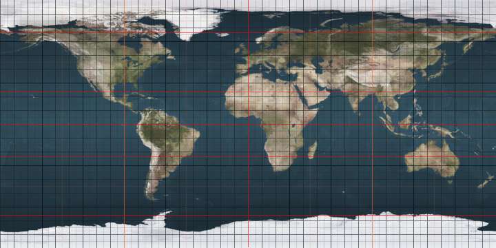
The 16th parallel south is a circle of latitude that is 16 degrees south of the Earth's equatorial plane. It crosses the Atlantic Ocean, Africa, the Indian Ocean, Australasia, the Pacific Ocean and South America.

A section of the border between Mozambique and Zimbabwe is defined by the parallel.

Around the world

Starting at the Prime Meridian and heading eastwards, the parallel 16° south passes through:

Co-ordinates Country, territory or sea Notes
16°0′S 0°0′E / 16.000°S 0.000°E / -16.000; 0.000 (Prime Meridian) Atlantic Ocean
16°0′S 11°48′E / 16.000°S 11.800°E / -16.000; 11.800 (Angola)  Angola
16°0′S 22°0′E / 16.000°S 22.000°E / -16.000; 22.000 (Zambia)  Zambia
16°0′S 28°53′E / 16.000°S 28.883°E / -16.000; 28.883 (Zimbabwe)  Zimbabwe
16°0′S 30°25′E / 16.000°S 30.417°E / -16.000; 30.417 (Mozambique / Zimbabwe border)  Mozambique /  Zimbabwe border
16°0′S 30°55′E / 16.000°S 30.917°E / -16.000; 30.917 (Mozambique)  Mozambique For about 20 km
16°0′S 31°6′E / 16.000°S 31.100°E / -16.000; 31.100 (Zimbabwe)  Zimbabwe For about 9 km
16°0′S 31°11′E / 16.000°S 31.183°E / -16.000; 31.183 (Mozambique)  Mozambique
16°0′S 34°22′E / 16.000°S 34.367°E / -16.000; 34.367 (Malawi)  Malawi
16°0′S 35°49′E / 16.000°S 35.817°E / -16.000; 35.817 (Mozambique)  Mozambique
16°0′S 40°7′E / 16.000°S 40.117°E / -16.000; 40.117 (Indian Ocean) Indian Ocean Mozambique Channel
16°0′S 45°9′E / 16.000°S 45.150°E / -16.000; 45.150 (Madagascar)  Madagascar
16°0′S 49°41′E / 16.000°S 49.683°E / -16.000; 49.683 (Indian Ocean) Indian Ocean Passing just south of Tromelin Island,  French Southern and Antarctic Lands
Passing just north of Albatross Island,  Mauritius
16°0′S 124°29′E / 16.000°S 124.483°E / -16.000; 124.483 (Australia)  Australia Western Australia
Northern Territory
16°0′S 137°12′E / 16.000°S 137.200°E / -16.000; 137.200 (Gulf of Carpentaria) Gulf of Carpentaria
16°0′S 141°24′E / 16.000°S 141.400°E / -16.000; 141.400 (Australia)  Australia Queensland
16°0′S 145°26′E / 16.000°S 145.433°E / -16.000; 145.433 (Coral Sea) Coral Sea Passing through the Coral Sea Islands Territory,  Australia
16°0′S 167°11′E / 16.000°S 167.183°E / -16.000; 167.183 (Vanuatu)  Vanuatu Island of Malakula
16°0′S 167°23′E / 16.000°S 167.383°E / -16.000; 167.383 (Pacific Ocean) Pacific Ocean Coral Sea
16°0′S 168°14′E / 16.000°S 168.233°E / -16.000; 168.233 (Vanuatu)  Vanuatu Pentecost Island
16°0′S 167°23′E / 16.000°S 167.383°E / -16.000; 167.383 (Pacific Ocean) Pacific Ocean Passing just north of Vanua Levu island,  Fiji
Passing just north of Qelelevu island,  Fiji
Passing just south of Niuatoputapu island,  Tonga
Passing just south of Motu One atoll,  French Polynesia
Passing just north of Tupai atoll,  French Polynesia
Passing just south of Makatea atoll,  French Polynesia
Passing just south of Kaukura atoll,  French Polynesia
Passing just north of Niau atoll,  French Polynesia
16°0′S 145°58′W / 16.000°S 145.967°W / -16.000; -145.967 (French Polynesia)  French Polynesia Passing through Toau atoll
16°0′S 145°53′W / 16.000°S 145.883°W / -16.000; -145.883 (Pacific Ocean) Pacific Ocean Passing just north of Fakarava atoll,  French Polynesia
Passing just south of Kauehi atoll,  French Polynesia
Passing just north of Raraka atoll,  French Polynesia
16°0′S 142°26′W / 16.000°S 142.433°W / -16.000; -142.433 (French Polynesia)  French Polynesia Passing through Raroia atoll
16°0′S 142°19′W / 16.000°S 142.317°W / -16.000; -142.317 (Pacific Ocean) Pacific Ocean Passing just south of Takume atoll,  French Polynesia
Passing just south of Fangatau atoll,  French Polynesia
16°0′S 140°10′W / 16.000°S 140.167°W / -16.000; -140.167 (French Polynesia)  French Polynesia Passing through Fakahina atoll
16°0′S 140°6′W / 16.000°S 140.100°W / -16.000; -140.100 (Pacific Ocean) Pacific Ocean
16°0′S 74°2′W / 16.000°S 74.033°W / -16.000; -74.033 (Peru)  Peru The border with Bolivia is in Lake Titicaca
16°0′S 69°17′W / 16.000°S 69.283°W / -16.000; -69.283 (Bolivia)  Bolivia
16°0′S 60°11′W / 16.000°S 60.183°W / -16.000; -60.183 (Brazil)  Brazil Mato Grosso
Goiás
Brazilian Federal District - passing just south of Brasilia
Goiás - for about 18 km
Minas Gerais
Bahia
16°0′S 38°55′W / 16.000°S 38.917°W / -16.000; -38.917 (Atlantic Ocean) Atlantic Ocean
16°0′S 5°46′W / 16.000°S 5.767°W / -16.000; -5.767 (St Helena)  Saint Helena, Ascension and Tristan da Cunha Island of Saint Helena
16°0′S 5°42′W / 16.000°S 5.700°W / -16.000; -5.700 (Atlantic Ocean) Atlantic Ocean

See also

This article is issued from Wikipedia - version of the 5/3/2016. The text is available under the Creative Commons Attribution/Share Alike but additional terms may apply for the media files.