16th parallel north

16°
16th parallel north

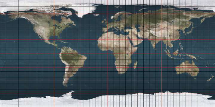
The 16th parallel north is a circle of latitude that is 16 degrees north of the Earth's equatorial plane. It crosses Africa, Asia, the Indian Ocean, the Pacific Ocean, Central America, the Caribbean and the Atlantic Ocean.

At this latitude the sun is visible for 13 hours, 5 minutes during the summer solstice and 11 hours, 11 minutes during the winter solstice.[1]

As a dividing line

After World War II, the parallel divided Vietnam into Chinese and British controlled zones; this eventually formed the Communist North Vietnam and the anti-communist South Vietnam. (See Timeline of World War II (1945).)

In the Chadian–Libyan conflict, from 1984 the parallel, known as the "Red Line", delineated areas controlled by opposing combatants. Previously the Red Line had been the 15th parallel north. (See also Operation Manta.)

Around the world

Starting at the Prime Meridian and heading eastwards, the parallel 16° north passes through:

Co-ordinates Country, territory or sea Notes
16°0′N 0°0′E / 16.000°N 0.000°E / 16.000; 0.000 (Prime Meridian)  Mali
16°0′N 4°0′E / 16.000°N 4.000°E / 16.000; 4.000 (Niger)  Niger
16°0′N 14°39′E / 16.000°N 14.650°E / 16.000; 14.650 (Chad)  Chad
16°0′N 24°0′E / 16.000°N 24.000°E / 16.000; 24.000 (Sudan)  Sudan
16°0′N 36°50′E / 16.000°N 36.833°E / 16.000; 36.833 (Eritrea)  Eritrea
16°0′N 39°16′E / 16.000°N 39.267°E / 16.000; 39.267 (Red Sea) Red Sea
16°0′N 40°3′E / 16.000°N 40.050°E / 16.000; 40.050 (Eritrea)  Eritrea Island of Nahaleg
16°0′N 40°5′E / 16.000°N 40.083°E / 16.000; 40.083 (Red Sea) Red Sea
16°0′N 42°49′E / 16.000°N 42.817°E / 16.000; 42.817 (Yemen)  Yemen
16°0′N 52°10′E / 16.000°N 52.167°E / 16.000; 52.167 (Indian Ocean) Indian Ocean Arabian Sea
16°0′N 73°29′E / 16.000°N 73.483°E / 16.000; 73.483 (India)  India Maharashtra
Karnataka
Andhra Pradesh
16°0′N 81°9′E / 16.000°N 81.150°E / 16.000; 81.150 (Indian Ocean) Indian Ocean Bay of Bengal
16°0′N 94°13′E / 16.000°N 94.217°E / 16.000; 94.217 (Myanmar)  Myanmar (Burma) Irrawaddy River delta
16°0′N 95°41′E / 16.000°N 95.683°E / 16.000; 95.683 (Indian Ocean) Indian Ocean Gulf of Martaban, Andaman Sea
16°0′N 97°35′E / 16.000°N 97.583°E / 16.000; 97.583 (Myanmar)  Myanmar (Burma)
16°0′N 98°36′E / 16.000°N 98.600°E / 16.000; 98.600 (Thailand)  Thailand
16°0′N 105°25′E / 16.000°N 105.417°E / 16.000; 105.417 (Laos)  Laos
16°0′N 107°27′E / 16.000°N 107.450°E / 16.000; 107.450 (Vietnam)  Vietnam
16°0′N 108°16′E / 16.000°N 108.267°E / 16.000; 108.267 (South China Sea) South China Sea Passing through the disputed Paracel Islands
16°0′N 119°45′E / 16.000°N 119.750°E / 16.000; 119.750 (Philippines)  Philippines Island of Luzon
16°0′N 121°39′E / 16.000°N 121.650°E / 16.000; 121.650 (Pacific Ocean) Pacific Ocean Philippine Sea
Passing just south of the island of Farallon de Medinilla,  Northern Mariana Islands
into an unnamed part of the Ocean
16°0′N 97°50′W / 16.000°N 97.833°W / 16.000; -97.833 (Mexico)  Mexico
16°0′N 95°24′W / 16.000°N 95.400°W / 16.000; -95.400 (Pacific Ocean) Pacific Ocean Gulf of Tehuantepec
16°0′N 93°59′W / 16.000°N 93.983°W / 16.000; -93.983 (Mexico)  Mexico
16°0′N 91°46′W / 16.000°N 91.767°W / 16.000; -91.767 (Guatemala)  Guatemala
16°0′N 89°13′W / 16.000°N 89.217°W / 16.000; -89.217 (Belize)  Belize
16°0′N 88°54′W / 16.000°N 88.900°W / 16.000; -88.900 (Caribbean Sea) Caribbean Sea Passing just north of Punta de Manabique,  Guatemala
Passing just south of the island of Útila,  Honduras
16°0′N 85°58′W / 16.000°N 85.967°W / 16.000; -85.967 (Honduras)  Honduras
16°0′N 85°53′W / 16.000°N 85.883°W / 16.000; -85.883 (Caribbean Sea) Caribbean Sea Passing just north of Cape Camarón,  Honduras
16°0′N 61°44′W / 16.000°N 61.733°W / 16.000; -61.733 (France)  France Island of Basse-Terre, Guadeloupe
16°0′N 61°35′W / 16.000°N 61.583°W / 16.000; -61.583 (Atlantic Ocean) Atlantic Ocean
16°0′N 61°17′W / 16.000°N 61.283°W / 16.000; -61.283 (France)  France Island of Marie-Galante, Guadeloupe
16°0′N 61°15′W / 16.000°N 61.250°W / 16.000; -61.250 (Atlantic Ocean) Atlantic Ocean
16°0′N 22°55′W / 16.000°N 22.917°W / 16.000; -22.917 (Cape Verde)  Cape Verde Island of Boa Vista
16°0′N 22°46′W / 16.000°N 22.767°W / 16.000; -22.767 (Atlantic Ocean) Atlantic Ocean
16°0′N 16°30′W / 16.000°N 16.500°W / 16.000; -16.500 (Senegal)  Senegal
16°0′N 13°22′W / 16.000°N 13.367°W / 16.000; -13.367 (Mauritania)  Mauritania
16°0′N 5°24′W / 16.000°N 5.400°W / 16.000; -5.400 (Cape Verde)  Mali

See also

18th parallel

References

This article is issued from Wikipedia - version of the 7/24/2016. The text is available under the Creative Commons Attribution/Share Alike but additional terms may apply for the media files.