Čermná, Domažlice District
| Čermná | |||
|---|---|---|---|
| Municipality | |||
 | |||
| |||
 Čermná | |||
| Coordinates: 49°32′1″N 13°7′4″E / 49.53361°N 13.11778°ECoordinates: 49°32′1″N 13°7′4″E / 49.53361°N 13.11778°E | |||
| Country |
| ||
| Region | Plzeň | ||
| District | Domažlice | ||
| Area | |||
| • Total | 3.25 km2 (1.25 sq mi) | ||
| Elevation | 436 m (1,430 ft) | ||
| Population (2006) | |||
| • Total | 230 | ||
| • Density | 71/km2 (180/sq mi) | ||
| Postal code | 345 61 | ||
| Website | http://www.cermna.cz | ||
_vlajka.jpg)
_znak.jpg)
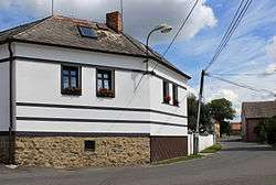
Čermná is a village and municipality (obec) in Domažlice District in the Plzeň Region of the Czech Republic.
The municipality covers an area of 3.25 square kilometres (1.25 sq mi) and had a population of 230 on 3 July 2006.
Čermná is approximately 18 kilometres (11 mi) north-east of Domažlice, 31 km (19 mi) south-west of Plzeň and 112 km (70 mi) south-west of Prague.
External links
| Wikimedia Commons has media related to Čermná (Domažlice District). |
This article is issued from Wikipedia - version of the 9/12/2016. The text is available under the Creative Commons Attribution/Share Alike but additional terms may apply for the media files.