Île d'Orléans Bridge
| Orleans Island Bridge Pont de l'Île d'Orléans | |
|---|---|
 | |
| Coordinates | 46°52′49″N 71°08′16″W / 46.880233°N 71.137883°WCoordinates: 46°52′49″N 71°08′16″W / 46.880233°N 71.137883°W |
| Carries | Quebec Route 368 |
| Crosses | St. Lawrence River |
| Locale | Quebec City and Île d'Orléans |
| Characteristics | |
| Design | Suspension bridge |
| Total length | 4.43 km (2.75 mi) |
| Width | 9.6 m (31 ft) |
| Height | 65.88 m (216.1 ft) to top of towers |
| Longest span | 323 m (1,060 ft)[1] |
| Number of lanes | 2 |
| History | |
| Opened | 1935 |
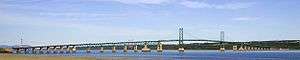
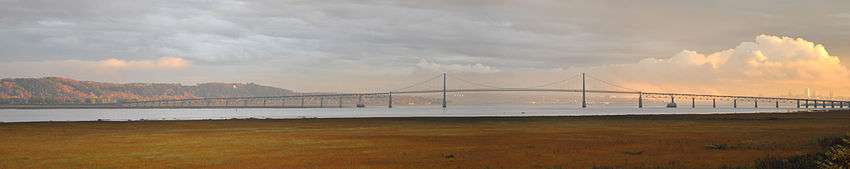
The Île d'Orléans Bridge, known locally as the Pont de l'Île, is a suspension bridge that spans the Saint Lawrence River between the Beauport borough of Quebec City and Île d'Orléans (Orléans Island) in the Canadian province of Quebec. It is part of Quebec Route 368 and connects to Autoroute 40 on the north side.
The island was originally accessible only by ferry or by ice bridge during the winter. An electoral promise made by Premier Louis-Alexandre Taschereau to Montmorency County for a job-creation project during the Great Depression led to the construction of this bridge in 1934. It was completed in 1935 and initially named Taschereau Bridge.[2]
It is the farthest downstream of the Saint Lawrence River's fixed crossings, but it does not cross the entire river.
See also
References
- ↑ "Orleans Island Bridge (1935)". Structurae.com. Retrieved May 8, 2012.
- ↑ "Discover the Island". Courtepointe et Cafe Association of B&Bs on Orleans Island. Retrieved 2009-10-29.
External links
| Boroughs |  | |
|---|---|---|
| Districts | ||
| Agglomeration | ||
| Enclaves | ||
| ||
| Bridges of the St. Lawrence River | ||||
|---|---|---|---|---|
| ||||