Épaumesnil
| Épaumesnil | |
|---|---|
|
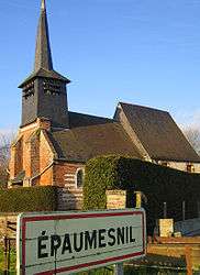
The church | |
 Épaumesnil | |
|
Location within Hauts-de-France region  Épaumesnil | |
| Coordinates: 49°54′46″N 1°51′13″E / 49.9128°N 1.8536°E / 49.9128; 1.8536Coordinates: 49°54′46″N 1°51′13″E / 49.9128°N 1.8536°E / 49.9128; 1.8536 | |
| Country | France |
| Region | Hauts-de-France |
| Department | Somme |
| Arrondissement | Abbeville |
| Canton | Oisemont |
| Intercommunality | Canton of Oisemont |
| Government | |
| • Mayor (2001–2008) | Gilles Boudernel |
| Area1 | 4.74 km2 (1.83 sq mi) |
| Population (2006)2 | 116 |
| • Density | 24/km2 (63/sq mi) |
| Time zone | CET (UTC+1) |
| • Summer (DST) | CEST (UTC+2) |
| INSEE/Postal code | 80269 / 80140 |
| Elevation |
68–129 m (223–423 ft) (avg. 60 m or 200 ft) |
|
1 French Land Register data, which excludes lakes, ponds, glaciers > 1 km² (0.386 sq mi or 247 acres) and river estuaries. 2 Population without double counting: residents of multiple communes (e.g., students and military personnel) only counted once. | |
Épaumesnil is a commune in the Somme department in Hauts-de-France in northern France.
Geography
Épaumesnil is situated on the D96 road, some 37 km (23 mi) west of Amiens.
Population
| Year | 1962 | 1968 | 1975 | 1982 | 1990 | 1999 | 2006 |
|---|---|---|---|---|---|---|---|
| Population | 101 | 117 | 119 | 109 | 119 | 107 | 116 |
| From the year 1962 on: No double counting—residents of multiple communes (e.g. students and military personnel) are counted only once. | |||||||
See also
References
External links
| Wikimedia Commons has media related to Épaumesnil. |
- Épaumesnil on the Quid website (French)
This article is issued from Wikipedia - version of the 11/8/2016. The text is available under the Creative Commons Attribution/Share Alike but additional terms may apply for the media files.