Ålhus
| Ålhus | |
|---|---|
| Village | |
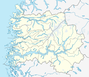 Ålhus  Ålhus Location in Sogn og Fjordane county | |
| Coordinates: 61°31′49″N 06°13′55″E / 61.53028°N 6.23194°ECoordinates: 61°31′49″N 06°13′55″E / 61.53028°N 6.23194°E | |
| Country | Norway |
| Region | Western Norway |
| County | Sogn og Fjordane |
| District | Sunnfjord |
| Municipality | Jølster |
| Elevation[1] | 210 m (690 ft) |
| Population (2007) | |
| • Total | 262 |
| Time zone | CET (UTC+01:00) |
| • Summer (DST) | CEST (UTC+02:00) |
| Post Code | 6847 Vassenden |
Ålhus is a small village in the municipality of Jølster in Sogn og Fjordane county, Norway. It is located along the European route E39 highway on the northern side of the lake Jølstravatnet, in a largely agricultural area. Ålhus is located about 15 kilometres (9.3 mi) west of the villages of Helgheim and Skei and about 8 kilometres (5.0 mi) northeast of the villages of Vassenden and Langhaugane.
Ålhus is the millennium center of Jølster, due to its historical significance. Audun Hugleiksson erected a stone castle called Audunborg here in the 13th century. Ålhus Church, the oldest church in the municipality, is also located here. Nikolai Astrup, the famous Norwegian painter, grew up here.[2]
References
- ↑ "Ålhus, Jølster" (in Norwegian). yr.no. Retrieved 2013-11-25.
- ↑ Store norske leksikon. "Ålhus" (in Norwegian). Retrieved 2010-08-07.
This article is issued from Wikipedia - version of the 8/1/2016. The text is available under the Creative Commons Attribution/Share Alike but additional terms may apply for the media files.