Ålfoten
| Ålfoten | |
|---|---|
| Village | |
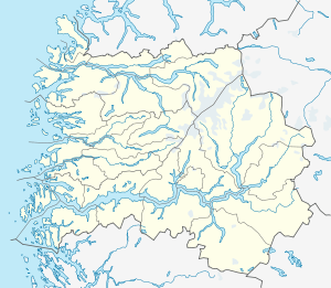 Ålfoten  Ålfoten Location in Sogn og Fjordane county | |
| Coordinates: 61°50′20″N 05°40′28″E / 61.83889°N 5.67444°ECoordinates: 61°50′20″N 05°40′28″E / 61.83889°N 5.67444°E | |
| Country | Norway |
| Region | Western Norway |
| County | Sogn og Fjordane |
| District | Nordfjord |
| Municipality | Bremanger Municipality |
| Elevation[1] | 26 m (85 ft) |
| Time zone | CET (UTC+01:00) |
| • Summer (DST) | CEST (UTC+02:00) |
| Post Code | 6737 Ålfoten |
Ålfoten is a village in Bremanger Municipality in Sogn og Fjordane county, Norway. The village is located along the Ålfotfjorden, a branch off the south side of the main Nordfjorden. The population (2001) of the village is 181.[2] The village has an elementary school and the Ålfoten Church which was built in 1678. The village was part of the (former) municipality of Davik until 1965 when it was incorporated into Bremanger.[3]
Ålfoten is located at the confluence of the river Sagelva and the Ålfotfjorden (a branch of the Nordfjorden), about 6 kilometres (3.7 mi) south of the village of Isane, 16 kilometres (9.9 mi) southeast of the village of Davik, and 23 kilometres (14 mi) east of the municipal center of Svelgen. The Ålfotbreen glacier lies about 10 kilometres (6.2 mi) to the south of the village.
Media gallery
 Ålfoten church
 View of Ålfoten village
References
- ↑ "Ålfoten" (in Norwegian). yr.no. Retrieved 2013-10-30.
- ↑ Statistisk sentralbyrå (2001). "Folke- og boligtellingen 2001, kommune- og bydelshefter 1438 Bremanger" (PDF) (in Norwegian).
- ↑ Store norske leksikon. "Ålfoten" (in Norwegian). Retrieved 2010-06-03.