Xiazayü
| Xiazayü 下察隅镇 | |
|---|---|
| Town | |
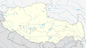 Xiazayü Location in Tibet | |
| Coordinates: 28°29′16″N 97°01′22″E / 28.48778°N 97.02278°ECoordinates: 28°29′16″N 97°01′22″E / 28.48778°N 97.02278°E | |
| Country | People's Republic of China |
| Region | Tibet |
| Prefecture | Nyingchi |
| County | Zayü |
| Village-level divisions | 18 villages |
| Area | |
| • Total | 1,215.07 km2 (469.14 sq mi) |
| Elevation | 1,542 m (5,059 ft) |
| Population (2005) | |
| • Total | 5,389 |
| • Density | 4.4/km2 (11/sq mi) |
| Time zone | China Standard (UTC+8) |
Xiazayü (Chinese: 下察隅; pinyin: Xiàcháyú; literally: "lower Zayü"; Standard Tibetan: རྫ་ཡུལ་རོང་སྨད།)[1] is a town of Zayü County, in southeastern Tibet Autonomous Region, People's Republic of China (PRC),[2] located in a deep river valley 47 km (29 mi) from the county seat and bordering India's Arunachal Pradesh, which is claimed by the PRC, to the southwest, as well as Burma to the southeast. As of 2005, it has a population of 5389 residing in an area of 1,215.07 km2 (469.14 sq mi),[3] and as of 2011, it has 18 villages under its administration.[4] The town contains a population of the Mishmi people (or Deng people), which has yet to be officially recognised as one of the PRC's 56 ethnicities. Tourism was developing in the Shaqiong Deng Village (沙瓊僜人村).[5] However, foreigners were not allowed to enter Zayü as of 2011.
References
- ↑ [远方的家 720HD] 边疆行 (38) 秘境察隅 / 做客登人山寨 1/3 at 9:14
- ↑ 2011年统计用区划代码和城乡划分代码:察隅县 (in Chinese). National Bureau of Statistics of the People's Republic of China. Retrieved 2012-07-16.
- ↑ 下察隅镇基本情况 Archived August 20, 2007, at the Wayback Machine.
- ↑ 2011年统计用区划代码和城乡划分代码:下察隅镇 (in Chinese). National Bureau of Statistics of the People's Republic of China. Retrieved 2012-07-16.
- ↑ http://big5.xinhuanet.com/gate/big5/news.xinhuanet.com/politics/2011-06/26/c_121586305.htm