Tappoch Broch
Coordinates: 56°02′37″N 3°52′28″W / 56.043487°N 3.874351°W
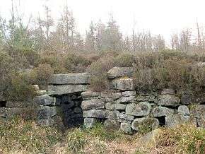 Southern side of Tappoch Broch | |
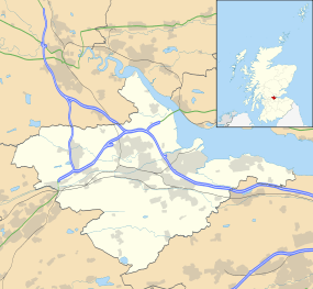 Location in Falkirk, Scotland | |
| Location | Falkirk |
|---|---|
| Coordinates | 56°02′37″N 3°52′28″W / 56.043487°N 3.874351°W |
| Type | Broch |
| History | |
| Periods | Iron Age, Roman |
Tappoch Broch, better known as Torwood Broch, is an iron-age broch located near Falkirk, Scotland.
Location
The Broch is located in the Falkirk Council area in central Scotland.[1]
History
Tappoch broch was first excavated in 1864 [2] by Colonel Joseph Dundas. Small-scale excavations have taken place near the site sporadically since. Recently, a conservation project run by Archaeology Scotland and grant aided by Forestry Commission Scotland cleared the site of scrub vegetation. The broch was then surveyed by laser scanning.
Archaeological Finds
Unlike other Lowland Brochs such as Leckie Broch artefacts recovered from Tappoch were relatively sparse with no Roman material on site. Finds included saddle and rotary querns, a potential stone 'lamp' and several sherds of coarse pottery.
References
- ↑ RCAHMS. "Tappoch Broch (47004)". Canmore. Retrieved 13 July 2014.
- ↑ Dundas (1868) Notes on the excavation of an ancient building at Tapock in the Torwood, Parish of Dunipace, County of Stirling, Proceedings of the Society of Antiquaries of Scotland, vol. 6, pp 259-65. Last Accessed 13 July 2014
External links
- Tappoch Broch - Undiscovered Scotland: The Ultimate Online Guide
- Torwood Broch Poster - Forestry Commission Scotland
Images
![]() Media related to Tappoch Broch at Wikimedia Commons
Media related to Tappoch Broch at Wikimedia Commons
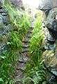 Tappoch Broch stairs
 Tappoch Broch entrance
 Tappoch Broch Stairwell
 The approach to Tappoch Broch
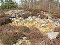 Tappoch Broch - northern side