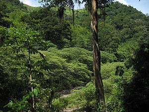
Sierra de Agalta National Park
| Sierra de Agalta National Park | |
|---|---|
|
IUCN category II (national park) | |
 | |
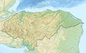 Location of Sierra de Agalta in Honduras | |
| Location | Honduras |
| Coordinates | 15°00′37″N 85°51′09″W / 15.01028°N 85.85250°WCoordinates: 15°00′37″N 85°51′09″W / 15.01028°N 85.85250°W[1] |
| Area | 207.85 km2 (80.25 sq mi)[1] |
| Established | 1 January 1987[1] |
Sierra de Agalta National Park is a national park in Honduras. It was established on 1 January 1987 and covers an area of 207.85 square kilometres. It has an altitude of between 1,800 and 2,354 metres.[1]
References
- 1 2 3 4 "Honduras - Sierra de Agalta". United Nations Environment Programme. Retrieved 1 March 2010.
This article is issued from Wikipedia - version of the 11/19/2016. The text is available under the Creative Commons Attribution/Share Alike but additional terms may apply for the media files.