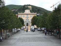
San Giuliano Terme
| San Giuliano Terme Bagni di San Giuliano | |
|---|---|
| Comune | |
| Comune di San Giuliano Terme | |
 | |
 San Giuliano Terme Location of San Giuliano Terme in Italy | |
| Coordinates: 43°45′40″N 10°26′25″E / 43.76111°N 10.44028°E | |
| Country | Italy |
| Region | Tuscany |
| Province / Metropolitan city | Pisa (PI) |
| Frazioni | Agnano, Arena-Metato, Asciano Pisano, Campo, Colignola, Colognole, Corliano, Gello, Ghezzano, La Figuretta, Madonna dell'Acqua, Mezzana, Mirteto, Molina di Quosa, Orzignano, Limiti, Pappiana, Patrignone, Pontasserchio, Pugnano, Rigoli, Ripafratta, San Martino a Ulmiano, Sant'Andrea in Pescaiola |
| Government | |
| • Mayor | Paolo Panattoni (Centre-left coalition) |
| Area | |
| • Total | 91.7 km2 (35.4 sq mi) |
| Elevation | 6 m (20 ft) |
| Population (June 2008)[1] | |
| • Total | 31,220 |
| • Density | 340/km2 (880/sq mi) |
| Demonym(s) | Sangiulianesi |
| Time zone | CET (UTC+1) |
| • Summer (DST) | CEST (UTC+2) |
| Postal code | 56017 |
| Dialing code | 050 |
| Patron saint | St. Bartholomew the Apostle |
| Saint day | 24 August |
| Website | Official website |
San Giuliano Terme is a comune (municipality) in the Province of Pisa in the Italian region Tuscany, located about 80 kilometres (50 mi) west of Florence and about 5 kilometres (3 mi) northeast of Pisa.
Main sights
The area of the Pisa hills was already an attraction for enlightened travellers in the early 18th century with the growth of the thermal spa of San Giuliano, just like those narrated by Carlo Goldoni and which we can continue to enjoy today. Among the prominent houses in the region are:
- Villa di Agnano
- Villa Le Molina
- Villa Roncioni
- Villa Tadini Buoninsegni
- Villa Alta
- Villa di Corliano. It houses frescoes painted by Andrea Boscoli from 1592.
Twin towns
 Bad Tölz, Germany, since 2003
References
External links
| Wikimedia Commons has media related to San Giuliano Terme. |
This article is issued from Wikipedia - version of the 10/8/2016. The text is available under the Creative Commons Attribution/Share Alike but additional terms may apply for the media files.