Salem, Ma'ale Iron
Salem
| |
|---|---|
|
Salem in 2016 | |
 Salem | |
| Coordinates: 32°32′26″N 35°12′5″E / 32.54056°N 35.20139°ECoordinates: 32°32′26″N 35°12′5″E / 32.54056°N 35.20139°E | |
| Grid position | 169/216 PAL |
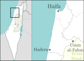
| District | Haifa |
| Population (2008) | |
| • Total | 1,600 |
| Name meaning | from a personal name[1] |

Salem or Salim (Arabic: سالم, Hebrew: סאלם) is an Arab village in Israel's Haifa District. The village is in the Wadi Ara area of the northern Triangle, 4 kilometers northeast of Umm al-Fahm. Since 1996, it has been under the jurisdiction of the Ma'ale Iron local council.[2] According to the 2008 census there were 1,600 residents in the village, predominantly Muslims. The village is divided into five neighborhoods: Abu Bakr, Darwish, Subaihat, Ayash and Rifai.[3] Most of the adult males in the village work in manual labour.[4]
History
Pottery from the Persian[5] and the Hellenistic era have been found, and a rock-hewn installation has been excavated from the latter period.[6]
Pottery and coins have been also been found from the Roman period,[7] in addition to pottery from the Byzantine,[7][8] early Islamic and Mamluk period.[7]
Ottoman era
Salem, like the rest of Palestine, was incorporated into the Ottoman Empire in 1517, and in the census of 1596, the village was located in the nahiya of Sara in the liwa of Lajjun. It had a population of 9 households, all Muslim. It paid a fixed tax of 25% on agricultural products, including wheat, barley, olive trees, goats and beehives, in addition to occasional revenues; the taxes totalled 4,300 akçe.[9]
In 1870, Victor Guérin found here "distinct traces" of ancient buildings.[10] In 1882, the Palestine Exploration Fund's Survey of Western Palestine described Salem as a "small village standing above the road, with a well on the north".[11]
British Mandate era
In the 1922 census the population of the village was 44, all Muslim.[12] Both in the 1931 census and in 1945 the population was counted with that of Rummanah.[13][14]
1948 war and State of Israel
During the 1948 Arab-Israeli War the village and the surrounding area came under Iraqi control.[15] In March 1949 Jordanian forces replaced the Iraqi forces in Wadi Ara.[15] On 3 April 1949 Israel and Jordan signed an armistice agreement in which Israel would receive the Wadi Ara area.[16] During the war, 15 refugee families settled in the village.[17]
In November 1954, a Jordanian force entered the village and attacked a squad of Magav policemen, wounding one.[18] The incident caused outrage because the villagers did not report that the village was captured and did not oppose the force, allowing it to attack Israeli security personal. The villagers claimed they were in their homes and didn't see anything.[19] The villagers had strong relations with the nearby Palestinian village of Rummanah, as two of Salem's clans originated in Rummanah. In the 1950s there was constant smuggling between the two villages.[19]
In the late 1950s, the Jewish kibbutz of Giv'at Oz established good relations with Salem as well as nearby Zalafa when a Kupat Holim clinic was built in the kibbutz which served the residents of Salem. Later the kibbutz provided water and transportation services to Salem and social contact was built up between both communities as the residents started learning Hebrew. The villagers started reporting the Israeli authorities about attacks coming from Jordan.[20]
Salem is one of the villages of Wadi Ara that lacked municipal status after the establishment of Israel.[21] and was under the administration of mukhtars (village headmen) who were appointed by the Interior Ministry.[22] and salem's muckhtar was named Taleb Abu Bakr[4] These mukhtars administrated the village until 1992, when the Interior Ministry established the Nahal Iron regional council, uniting it with seven other Arab villages. Salem was one of the two villages that cooperated with the council, while the other villages objected to the administrative arrangement and sought independent municipal status for each village. During this period most of the existing roads in Salem were paved. To allay local concerns in other villages, the Interior Ministry established an investigative committee to examine other options, and in 1996, decided to split the regional council into two local councils: Ma'ale Iron, which includes Salem, and Basma.[2]
Demograhics
Population
According to the 2008 census of the Central Bureau of Statistics (CBS), Salem had 1,600 residents, 99.9% of them Muslim.
49.8% were under age 17, 48.1% were aged 18–64, and 2.1% were over 65. The median age was 18.[23]
| Year | 1922 | 1961 | 1972 | 1983 | 1995 | 2008 |
|---|---|---|---|---|---|---|
| Population | 44 | 168 | 248 | 482 | 675 | 1,600 |
Labour
According to the 2008 CBS census, 32.5% of residents were in the annual civilian labour force; 60.4% of the men; 0.9% of the women. 49.3% of the male workforce worked in construction; 9.8% in wholesale, retail trade, and Auto Mechanism; 8.8% in manufacturing; and the rest in other sectors. 100% of the female workforce worked in education.[23]
Clans
Salem is divided into two parts. The western part is inhabited by members of the Abu Bakr clan which originated in Ya'bad; in 2001 this clan numbered 3,500, of which 3,000 lived in the West Bank and 500 lived in Israel–300 in Salem and 200 in nearby Zalafa. The eastern part is inhabited by members of the Araf'aiya and Subaihat clans, as well as some other clans.[4]
See also
References
- ↑ Palmer, 1881, p. 152
- 1 2 "רקע היסטורי" [Historical background]. Ma'ale Iron Regional Council (in Hebrew). Retrieved 23 April 2016.
- ↑ "מפקד אוכלוסין 2008 – מעלה עירון – איזור סטטיסטי 1" [2008 Census – Ma'ale Iron – Statistical area 1] (PDF) (in Hebrew). Israeli Central Bureau of Statistics. Retrieved 25 April 2016.
- 1 2 3 Gal, Sharon (16 April 2001). "יש לנו מזל שהיה אתם יהודי" [We were luckey they had a Jew with them]. Haaretz (in Hebrew). Retrieved 5 May 2016.
- ↑ "סלאם" [Salem] (in Hebrew). Mapa. Retrieved 26 April 2016.
- ↑ Mahamid, 2006, Salim (East)
- 1 2 3 Cohen and Haiman, 2008, Salim
- ↑ Dauphin, 1998, pp. 740–1
- ↑ Hütteroth and Abdulfattah, 1977, p. 159
- ↑ Guérin, 1875, pp. 230-232; mentioned in Conder and Kitchener, 1882, SWP II, p. 68
- ↑ Conder and Kitchener, 1882, SWP II, p. 45
- 1 2 Barron, 1923, Table IX, Sub-district of Jenin, p. 30
- ↑ Mills, 1932, p. 70
- ↑ Department of Statistics, 1945, p. 16
- 1 2 The Politics of Partition; King Abdullah, The Zionists, and Palestine 1921–1951 Avi Shlaim Oxford University Press Revised Edition 2004 ISBN 0-19-829459-X pp. 299, 312
- ↑ "Israel-Jordan Armistice Agreement". Ministry of Foreign Affairs. Retrieved 20 April 2016.
- ↑ Musa, Anas. "Salem" (in Arabic). PLS48.NET. Retrieved 26 April 2016.
- ↑ "ירדנים ירו על על משמר צה'י'ל" [Jordanians fired at an IDF gurad]. Davar (in Hebrew). 2 November 1954. Retrieved 27 April 2016.
- 1 2 "אנשי הכפר סאלים לא התנגדו ולא הזעיקו עזרה" [Salem residents didn't resist and didn't call for help]. Davar (in Hebrew). 22 November 1954. Retrieved 27 April 2016.
- ↑ Bernet, Michael (August 2004). page 44–45.
- ↑ Peretz, Issac (16 May 1986). "הודעה בדבר בצגת רשימות הבוחרים לכנסת לשנת פנקס החוברים ה'תשמ"ו/ה'תשמ"ז – 1986–1987" [Announcement about presentation of the lists of electors for the Knesset for Electoral Register year 5746-7 (1986–7)]. Ministry of Interior (Israel) (in Hebrew). Maariv. Retrieved 10 April 2016.
- ↑ "מעלה עירון [Ma'ale Iron]" (in Hebrew). Iron Construction Committee. Retrieved 13 May 2016.
- 1 2 3 "Census 2008 – Ma'ale Iron – Statistical Area 1" (PDF). Central Bureau of Statistics (Israel). Retrieved 5 May 2016.
- ↑ 1995 Census – List of communities, geographical characters and population 1948, 1961, 1972, 1983, 1995, Israel Central Bureau of Statistics. Retrieved 25 May 2016
Bibliography
- Barron, J. B., ed. (1923). Palestine: Report and General Abstracts of the Census of 1922. Government of Palestine.
- Bernet, Michael (August 2004). The Time of the Burning Sun: Six Days of War, Twelve Weeks of Hope. Chester and West. p. 44. ISBN 0975582518.
- Cohen, Michael; Haiman, Mordechai (2008-05-29). "Salim Final Report" (120). Hadashot Arkheologiyot – Excavations and Surveys in Israel.
- Conder, Claude Reignier; Kitchener, H. H. (1882). The Survey of Western Palestine: Memoirs of the Topography, Orography, Hydrography, and Archaeology. 2. London: Committee of the Palestine Exploration Fund.
- Dauphin, Claudine (1998). La Palestine byzantine, Peuplement et Populations. BAR International Series 726 (in French). III : Catalogue. Oxford: Archeopress. ISBN 0-860549-05-4.
- Department of Statistics (1945). Village Statistics, April, 1945. Government of Palestine.
- Guérin, Victor (1875). Description Géographique Historique et Archéologique de la Palestine (in French). 2: Samarie, pt. 2. Paris: L'Imprimerie Nationale.
- Hadawi, Sami (1970). Village Statistics of 1945: A Classification of Land and Area ownership in Palestine. Palestine Liberation Organization Research Centre.
- Hütteroth, Wolf-Dieter; Abdulfattah, Kamal (1977). Historical Geography of Palestine, Transjordan and Southern Syria in the Late 16th Century. Erlanger Geographische Arbeiten, Sonderband 5. Erlangen, Germany: Vorstand der Fränkischen Geographischen Gesellschaft. ISBN 3-920405-41-2.
- Mahamid, Khaled; Haiman, Mordechai (2006-12-11). "Salim (East)" (118). Hadashot Arkheologiyot – Excavations and Surveys in Israel.
- Mills, E., ed. (1932). Census of Palestine 1931. Population of Villages, Towns and Administrative Areas (PDF). Jerusalem: Government of Palestine.
- Morris, Benny (2004). The Birth of the Palestinian Refugee Problem Revisited. Cambridge University Press. ISBN 0-521-00967-7.
- Palmer, E. H. (1881). The Survey of Western Palestine: Arabic and English Name Lists Collected During the Survey by Lieutenants Conder and Kitchener, R. E. Transliterated and Explained by E.H. Palmer. Committee of the Palestine Exploration Fund.
- Zertal, Adam (2016). The Manasseh Hill Country Survey: From Nahal ‘Iron to Nahal Shechem. 3. Brill. ISBN 9004312307. (p. 96)
External links
| Wikimedia Commons has media related to Salim, Ma'ale Iron. |
- Welcome To Salim
- Survey of Western Palestine, Map 8: IAA, Wikimedia commons