Pukarani (Peru)
This article is about the mountain with an archaeological site of that name in the Puno Region, Peru. For other uses, see
Pukarani (disambiguation).
Pukarani (Aymara pukara fortress or a mountain of protection,[2] -ni a suffix to indicate ownership, "the one with a fortress", Hispanicized spelling Pucarani) is a mountain with an archaeological site of the same name in the Andes of Peru, about 4,301.9 m (14,114 ft) high. It is located in the Puno Region, Lampa Province, Nicasio District.[3]
The archaeological site of Pukarani was declared a National Cultural Heritage by Resolución Directoral Nacional No. 79.[4] It lies north of the mountain and archaeological site of Intikancha.
References
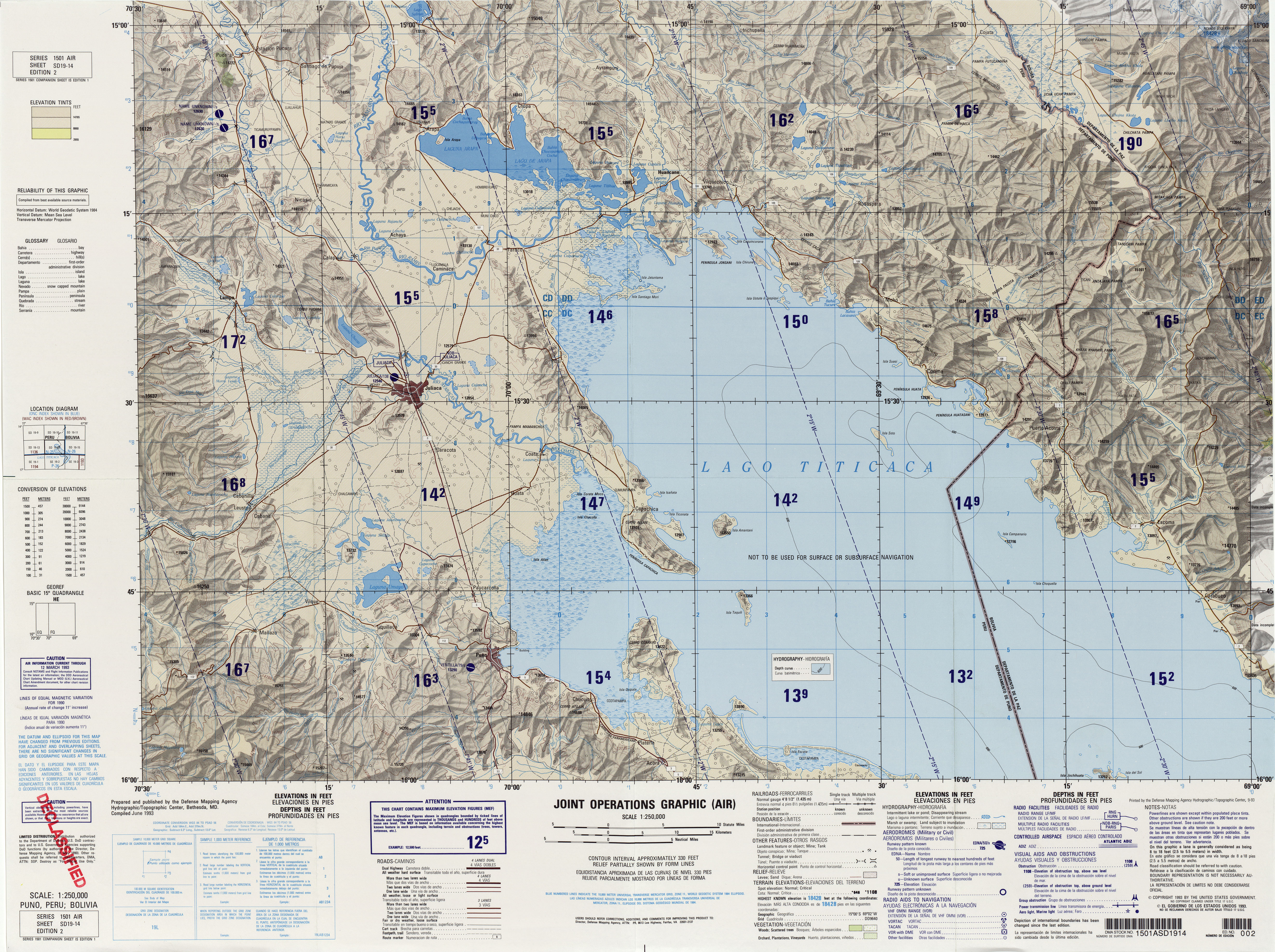
- ↑ "South America Maps". Joint Operations Graphic. Retrieved July 3, 2014.
- ↑ Ministerio de Educación, Dirección National de Educación Bilingue Intercultural, Yatiqirinaka Aru Pirwa, Lima, 2005 (Aymara-Spanish dictionary)
- ↑ escale.minedu.gob.pe - UGEL map of the Lampa Province (Puno Region)
- ↑ Patrimonio Cultural de la Nación (pdf)
|
|---|
|
- Acaray
- Amaru Marka Wasi
- Arhuaturo
- Asana
- Asiru Phat'jata
- Aspero
- Awila Qhincha Mach'ay
- Awkin Punta
- Awkillu Waqra
- Awkimarka (Apurímac)
- Awkimarka (Huánuco)
- Awqa Punta
- Aya Muqu
- Ayamach'ay
- Ayawayq'u
- Azángaro
- Baths of Boza
- Bandurria
- Buena Vista
- Cahuachi
- Cajamarquilla
- Cao Viejo
- Carajía
- Caral
- Caves of Sumbay
- Cerro Baúl
- Cerro Pátapo
- Cerro Trinidad
- Chakamarka
- Chan Chan
- Chankillo
- Chauchilla Cemetery
- Chavín de Huantar
- Chawaytiri
- Chichakuri
- Chipaw Marka
- Chuqik'iraw
- Chuqik'iraw Pukyu
- Chuqi Pukyu
- Churajón
- Chuya
- Ch'iqullu
- Cota Coca
- Cumbe Mayo
- El Brujo
- El Cañoncillo
- El Ingenio
- El Paraíso
- Garagay
- Gran Pajáten
- Gran Vilaya
- Guitarrero Cave
- Hatun Rumiyuq
- Hatun Mach'ay
- Hatun Misapata
- Hatun Uchku
- Hatun Usnu
- Hatunmarka
- Hunqupampa
- Inka Mach'ay
- Inka Raqay, Apurímac
- Inka Raqay, Ayacucho
- Inka Tampu, Cajamarca
- Inka Tampu, Huayopata
- Inka Tampu, Vilcabamba
- Inka Tunuwiri
- Inka Uyu
- Inka Wasi, Ayacucho
- Inka Wasi, Huancavelica
- Inka Wasi, Lima
- Inkapintay
- Inkill Tampu
- Inti Punku
- Inti Watana, Ayacucho
- Inti Watana, Calca
- Inti Watana, Urubamba
- Intikancha
- Intini Uyu Pata
- Intipa Ñawin
- Intiyuq K'uchu
- Iskuqucha
- Isuq
- Jinkiori
- Jisk'a Iru Muqu
- Kanichi
- Killa Mach'ay
- Killa Rumi
- Killarumiyuq
- Kiswar
- Kotosh
- Kuelap
- Kukuli
- Kuntur Wasi
- Kunturmarka, Ayacucho
- Kunturmarka, Pasco
- Kuntur Qaqa
- Kuntuyuq
- Kusichaka valley
- Kutimpu
- Khichuqaqa
- Khuchi Mach'ay
- K'allapayuq Urqu
- K'anamarka
- K'ipakhara
- Laguna de las Momias
- Lawriqucha
- Layzón
- Llamachayuq
- Llamachayuq Qaqa
- Llamayuq
- Llamuqa
- Llaqta Qulluy, Acoria
- Llaqta Qulluy, Conayca
- Llaqta Qulluy, Tayacaja
- Llaqta Qulluy, Vilca
- Llaqtan
- Llaqtapata
- Machu Pikchu
- Machu Pirqa
- Machu Pitumarka
- Machu Q'inti
- Machu Qullqa
- Mameria
- Maray Qalla
- Marayniyuq
- Markahirka
- Markansaya
- Markapukyu
- Markawamachuku
- Marpa
- Mawk'allaqta, Castilla
- Mawk'allaqta, Espinar
- Mawk'allaqta, La Unión
- Mawk'allaqta, Melgar
- Mawk'allaqta, Paruro
- Mawk'allaqta, Sandia
- Mawk'ataray
- Mayqu Amaya
- Mazur
- Mikulla
- Millka
- Miraflores
- Mirq'imarka
- Miyu Pampa
- Mulinuyuq
- Mullu Q'awa
- Mulluq'u
- Muray
- Muyu Muyu
- Muyu Urqu
- Muyuq Marka
- Nazca Lines
- Nina Kiru
- Ninamarka
- Ñawpallaqta, Huanca Sancos
- Ñawpallaqta, Fajardo
- Ñawpallaqta, Lucanas
- Ñust'a Hisp'ana
- Pacatnamu
- Pachakamaq
- Pachatusan
- Paiján
- Pañamarka
- Paracas Candelabra
- Paraxra
- Patallaqta
- Phiruru
- Pikillaqta
- Pikimach'ay
- Pilluchu
- Pinkuylluna
- Pirqa Pirqa, La Libertad
- Pirqa Pirqa, Lima
- Pirwalla
- Pirwayuq
- P'isaq
- Puka Pukara
- Puka Tampu
- Puka Urqu
- Pukara, Coporaque
- Pukara, Fajardo
- Pukara, Puno
- Pukara, Vilcas Huamán
- Pukarani
- Pumamarka, San Sebastián
- Pumamarka, Urubamba
- Pumaq Hirka
- Pumawasi
- Punkuri
- Puqin Kancha
- Puruchuco
- Purum Llaqta, Cheto
- Purum Llaqta, Soloco
- Pusharo
- Pusuquy Pata
- Phuyupatamarka
- Qaqapatan
- Qillqatani
- Quchapata
- Qillqa
- Qillqay Mach'ay
- Quchapampa
- Quiaca
- Qullqanpata
- Qullqapampa
- Qulu Qulu
- Qunchamarka
- Qunchupata
- Quri Winchus
- Qurikancha
- Qurimarka, Apurímac
- Qurimarka, Cusco
- Quriwayrachina, Anta
- Quriwayrachina, Ayacucho
- Quriwayrachina, La Convención
- Quyllur
- Q'arachupa
- Qasa Pata
- Qhapaq Kancha
- Q'illaywasin
- Q'inqu
- Q'inq'u
- Raimondi Stele
- Raqch'i
- Revash
- Rumiqullqa
- Rumiwasi
- Runayuq
- Runkuraqay
- Saksaywaman
- Sara Sara
- Sayaqmarka
- Sayhuite
- Sechin
- Sillustani
- Sipán
- Suntur
- Susupillu
- Tambo Totem
- Tampu Mach'ay, Cusco
- Tampu Mach'ay, Huancavelica
- Tampukancha
- Tanqa Tanqa
- Tantarica
- Taqrachullu
- Tarawasi
- Tarmatampu
- Templo del Zorro
- The Toads of Wiraqucha
- Tikra
- Tinyaq
- Tipón
- Titiqaqa
- Toquepala Caves
- Toro Muerto
- Trinchera
- Túcume
- Tunanmarka
- Tunay Q'asa
- Tupu Inka
- T'akaq
- T'uqu T'uquyuq
- Uchkus Inkañan
- Ullantaytampu
- Urpish
- Uskallaqta
- Usnu, Ayacucho
- Usnu, Huánuco
- Usnu Muqu
- Usqunta
- Uyu Uyu
- Venado cautivo
- Ventanillas de Otuzco
- Ventarron
- Vitcos
- Wak'a del Dragón
- Wak'a Wallamarka
- Wak'a de la Luna
- Wak'a del Sol
- Wak'a of San Marcos
- Wak'a of Santa Ana
- Wak'a Prieta
- Wak'a Pukllana
- Wallpayunka
- Waman Pirqa
- Wamanilla
- Wamanmarka, Chumbivilcas
- Wamanmarka, La Convención
- Wamanmarka, Lima
- Wamp'uy
- Wanakawri, Cusco
- Wanakawri, Huánuco
- Wanqaran
- Wanuku Pampa
- Waqlamarka
- Waqramarka
- Waqra Pukara
- Waqutu
- Warahirka
- Waraqayuq
- Waraqu Urqu
- Warawtampu
- Wari ruins
- Wari Willka
- Waruq
- Wat'a, Cusco
- Wat'a, Huánuco
- Wayna Pikchu
- Wayna Q'inti
- Wayna Tawqaray
- Wayra Punku
- Wichama
- Wichqana
- Wich'un
- Wila Wilani
- Willka
- Willkapampa
- Willkaraqay
- Willkawaman
- Willkawayin
- Wiñaw
- Wiñay Wayna
- Wiraqucha Pirqa
- Wiraquchapampa
- Yanaca
- Yanaqi - Qillqamarka
- Yaynu
- Yuraq Mach'ay
|

