Kafr Jammal
| Kufr Jammal | |
|---|---|
| Other transcription(s) | |
| • Arabic | كفر جمّال |
|
Kufr Jammal | |
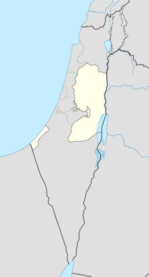 Kufr Jammal Location of Kufr Jammal within the Palestinian territories | |
| Coordinates: 32°13′31.03″N 35°02′38.58″E / 32.2252861°N 35.0440500°ECoordinates: 32°13′31.03″N 35°02′38.58″E / 32.2252861°N 35.0440500°E | |
| Governorate | Tulkarm |
| Government | |
| • Type | Village council |
| Population (2006) | |
| • Jurisdiction | 2,550 |
| Name meaning | The village of camels |

Kafr Jammal (Arabic: كفر جمّال), is a Palestinian town in the Tulkarm Governorate in the western edge of the West Bank. According to a census conducted in 1931 by the British Mandate authorities, Kfar Jammal had a population of 498 inhabitants, in 109 houses.[1] It is located about halfway between Qalqilyah and Tulkarm, and has a population of around 3,000. The village is mainly agricultural, and mostly raises olive and citrus crops. Kafr Jammal is at an altitude of 257 meters, and is bordered by Falamya in the west, Kafr Zibad in the east, Jayyous in the south, and Kafr Sur to the north.
Kafr Jammal enjoys good relations with neighboring territories, and heavy education and commercial exchange take place among them. The village is also notable for having a large diaspora outside the West Bank, mostly in Jordan, but also in Saudi Arabia and the United States. Kafr Jammal's population follow the Hanbali and Shafi'i fiqh (schools of Sunni Islam).
 Village center
 Orange crop
 Local cemetery
Bibliography
| Wikimedia Commons has media related to Kufr Jammal. |
- Barron, J. B., ed. (1923). Palestine: Report and General Abstracts of the Census of 1922. Government of Palestine.
- Conder, Claude Reignier; Kitchener, H. H. (1882). The Survey of Western Palestine: Memoirs of the Topography, Orography, Hydrography, and Archaeology. 2. London: Committee of the Palestine Exploration Fund. (p. 165)
- Dauphin, Claudine (1998). La Palestine byzantine, Peuplement et Populations. BAR International Series 726 (in French). III : Catalogue. Oxford: Archeopress. (p. 772)
- Hadawi, Sami (1970). Village Statistics of 1945: A Classification of Land and Area ownership in Palestine. Palestine Liberation Organization Research Center.
- Hütteroth, Wolf-Dieter; Abdulfattah, Kamal (1977). Historical Geography of Palestine, Transjordan and Southern Syria in the Late 16th Century. Erlanger Geographische Arbeiten, Sonderband 5. Erlangen, Germany: Vorstand der Fränkischen Geographischen Gesellschaft. ISBN 3-920405-41-2. (p. 140)
- Mills, E., ed. (1932). Census of Palestine 1931. Population of Villages, Towns and Administrative Areas. Jerusalem: Government of Palestine.
- Palmer, E. H. (1881). The Survey of Western Palestine: Arabic and English Name Lists Collected During the Survey by Lieutenants Conder and Kitchener, R. E. Transliterated and Explained by E.H. Palmer. Committee of the Palestine Exploration Fund. (p. 183)
External links
- Welcome To Kafr Abbush
- Survey of Western Palestine, Map 11: IAA, Wikimedia commons
| Cities |
|  |
|---|---|---|
| Municipalities | ||
| Villages |
| |
| Refugee camps | ||