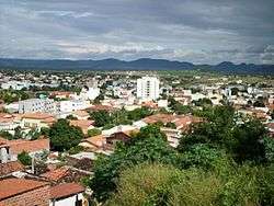
Guanambi
| Guanambi | |||
|---|---|---|---|
| Guanambi | |||
 | |||
| |||
| Nickname(s): Cidade do algodão (City of the cotton) | |||
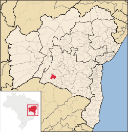 Guanambi in a Bahia map. | |||
| Coordinates: 14°13′22″S 42°46′51″W / 14.22278°S 42.78083°WCoordinates: 14°13′22″S 42°46′51″W / 14.22278°S 42.78083°W | |||
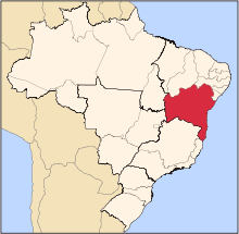
| Country | Brazil | ||
| Region | Northeast | ||
| State | Bahia | ||
| Demonym | guanambiense | ||
| Founded | August 14, 1919 | ||
| Government | |||
| • Mayor | Charles Fernandes (PP) | ||
| Area | |||
| • Total | 1,272.367 km2 (491.264 sq mi) | ||
| Elevation | 525 m (1,722 ft) | ||
| Population (2013) | |||
| • Total | 84,645 | ||
| • Density | 60.56/km2 (156.8/sq mi) | ||
| Time zone | UTC-3 (UTC-3) | ||
| • Summer (DST) | UTC-2 (UTC-2) | ||
| Website | [] | ||


Guanambi is a municipality in Bahia, Brazil, with an area of 1,272.367 km²,[1] and with 84,645 inhabitants in 2013, according to estimates by the IBGE,[2] making it the 20th most populous municipality of Bahia. It was founded in 1919 and Charles Fernandes is its current mayor.
It's distant 796 km (approximately 498 miles) south-west of Salvador, the capital being connected by the roads BR-030, BR-262 and BR-324, representing a strong influence in the commercial. The city is served by Guanambi Airport, and it is home of the largest wind complex in Latin America.[3]
References
- ↑ http://www.ibge.gov.br/home/geociencias/areaterritorial/area.php?nome=Guanambi&codigo=&submit.x=0&submit.y=0
- ↑ ftp://ftp.ibge.gov.br/Estimativas_de_Populacao/Estimativas_2015/estimativa_dou_2015.pdf
- ↑ http://www.ouvidoriageral.ba.gov.br/2012/07/10/inaugurado-na-bahia-o-maior-complexo-eolico-da-america-latina/
This article is issued from Wikipedia - version of the 11/14/2016. The text is available under the Creative Commons Attribution/Share Alike but additional terms may apply for the media files.