Consdorf
| Consdorf Konsdref | ||
|---|---|---|
| Commune | ||
|
Town hall | ||
| ||
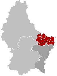
 Map of Luxembourg with Consdorf highlighted in orange, and the canton in dark red | ||
| Coordinates: 49°46′45″N 6°20′15″E / 49.7792°N 6.3375°ECoordinates: 49°46′45″N 6°20′15″E / 49.7792°N 6.3375°E | ||
| Country |
| |
| Canton | Echternach | |
| Government | ||
| • Mayor | André Poorters | |
| Area | ||
| • Total | 25.72 km2 (9.93 sq mi) | |
| Area rank | 34 of 105 | |
| Highest elevation | 393 m (1,289 ft) | |
| • Rank | 56th of 105 | |
| Lowest elevation | 219 m (719 ft) | |
| • Rank | 36th of 105 | |
| Population (2014) | ||
| • Total | 1,845 | |
| • Rank | 73rd of 105 | |
| • Density | 72/km2 (190/sq mi) | |
| • Density rank | 76th of 105 | |
| Time zone | CET (UTC+1) | |
| • Summer (DST) | CEST (UTC+2) | |
| LAU 2 | LU00006004 | |
| Website | consdorf.lu | |


Consdorf (Luxembourgish: Konsdref) is a commune and town in eastern Luxembourg. It is part of the canton of Echternach, which is part of the district of Grevenmacher.
As of 2005, the town of Consdorf, which lies in the centre of the commune, has a population of 1,200. Other towns within the commune include Scheidgen.
External links
| Wikivoyage has a travel guide for Consdorf. |
-
 Media related to Consdorf at Wikimedia Commons
 |
Berdorf | | ||
| Waldbillig Heffingen (L) |
|
Echternach | ||
| ||||
| | ||||
| Bech |
This article is issued from Wikipedia - version of the 12/1/2016. The text is available under the Creative Commons Attribution/Share Alike but additional terms may apply for the media files.