Blidinje
| Blidinje (Blidinje) | |
| Protected Area: Nature Park | |
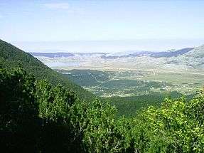 Valley and the lake | |
| Official name: Blidinje | |
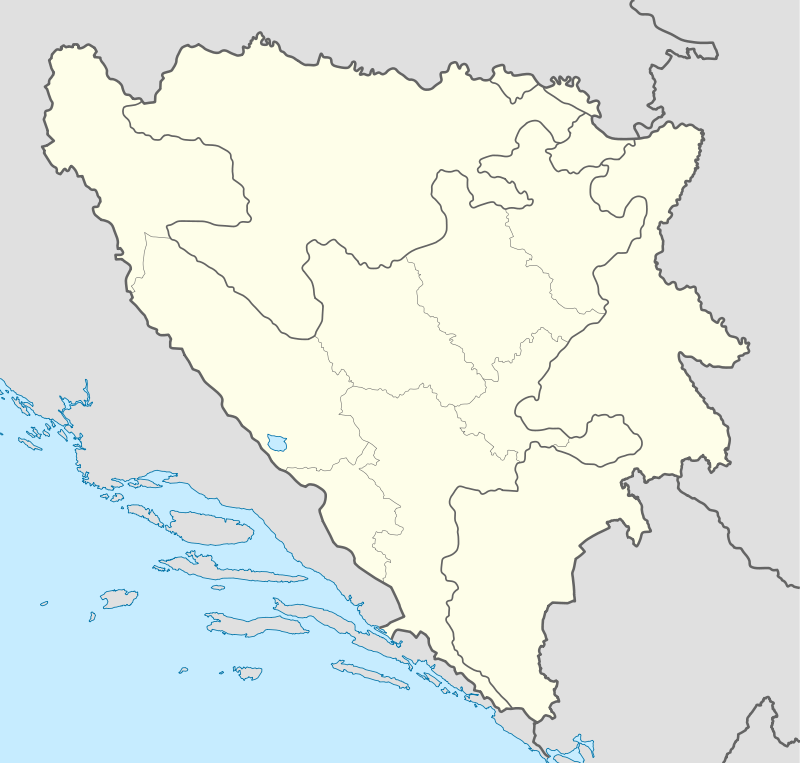
| Country | Bosnia and Herzegovina |
|---|---|
| State | |
| District | West Herzegovina Canton |
| Municipalities | Jablanica, Posušje, Tomislavgrad |
| Lake | 1
|
| Rivers | Grabovica, Doljanka, Neretva |
| Elevation | 1.150–1.300 m (4–4 ft) |
| Highest point | 1.300 |
| Lowest point | 1.150 |
| Length | 3–5 km (2–3 mi), S-N |
| Area | 364 km2 (141 sq mi) |
| Biomes | Mountain, Plateau, Lake, Forest |
| Geology | Limestone |
| Plants | Pinus leucodermis, Thyme, Pine |
| Founded | 1995 |
| Date | 1995 |
| Management | Blidinje Nature Park Public Enterprise |
| - location | Masna Luka - Posušje, Bosnia and Herzegovina |
| Owner | State of Bosnia and Herzegovina |
| For public | Free and with guide |
| Visitation | Open all year (Open all year) |
| Easiest access | State Road |
| Website: Blidinje Nature Park | |
| Blidinje Nature Park | |
|---|---|
|
IUCN category III (natural monument or feature) | |
 | |
| Coordinates | 43°36′39.06″N 17°30′31.59″E / 43.6108500°N 17.5087750°ECoordinates: 43°36′39.06″N 17°30′31.59″E / 43.6108500°N 17.5087750°E |
Blidinje is a Nature park in Bosnia and Herzegovina, established on 30 April 1995.
Geography and hydrology
It is a spacious valley, 3–5 km long, situated at an elevation of 1.150-1.300 meters a.s.l., between Čvrsnica and Vran mountains with a total area of 364 km² and 3 municipalities of Posušje, Tomislavgrad and Jablanica. To the North - North-West is Vran mountain with its highest peak on 2.074 meters a.s.l. while on the South - South-East is Čvrsnica mountain with its highest peak Ploča at 2.228 meters a.s.l., South is Čabulja mountain with its highest peak at 1.786 meters a.s.l., in the North - North-East is the Doljanka river and in the East is Grabovica valley that stretches to the Neretva river.
Grabovica valley
Grabovica valley with small Grabovica creek is a special reserve within park, squeezed deep into the mountain, and form a deep canyon between steep cliffs of Čvrsnica mountain. Within the valley is a small village Diva Grabovica, named after a daughter of a local shepherd, and killed by a local nobleman so that she would not be married to another man, except for him.
Blidinje lake
The melting glaciers from Čvrsnica during the two past ice ages created this open and barren valley Dugo Polje field leading into the park. The most important hydrographic phenomena in the area of the park is largest mountain lake in Bosnia and Herzegovina - Blidinje lake.
Blidinje lake is the direct result of a glacial retreat, but according to the Poklečani Parishes office documents, lake is, also, a product of anthropogenic intervention and activities of human inhabitants. According to these documents, in order to keep the water that is lost through the subterranean passage, local residents and cattle breeders sealed sinkholes with branches and clay, so that water could not find its way underground. Therefore, the lake was formed. Its surface area varies between 2,5 and 6 km², while its average depth is 1,9 m, with altitude of 1.184 m a.s.l.
Flora and fauna
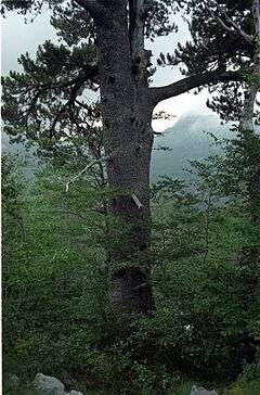
Accompanying some of the rocky and seemingly lifeless slopes are thick forests of pine, including the endemic white-bark pine at Masna Luka called Pinus leucodermis (Bosnian pine). Three types of wild thyme and dozens of wild flowers cover the valley and mountain sides in the spring and summer.
History, archaeology and culture
All around the valley is dotted with the Bosnia and Herzegovina trademark stećci from medieval ages. It is not clear how long human settlements have existed here but research began when Blidinje recently received Nature park status. Traces of Illyrian graves and Roman roads indicate that Blidinje has been settled for at least 2,500 years. The large necropolis at Dugo Polje indicates that the waves of Slavs that came in the 7th century also made this area their home.
Traditional life style
There is also a Franciscan monastery that is located within the park and open to visitors. Houses here are traditional shepherd homes with straw roofs that are mainly used during the spring and summer seasons. Winter is harsh and cold in these parts.
The park itself is free of mines with well-marked trails.
Trivia
A self-proclaimed micronation, a parodical project, is located in the middle of this Nature Park, Hajdučka Republika Mijata Tomića.
See also
- List of lakes in Bosnia and Herzegovina
- List of mountains in Bosnia and Herzegovina
- List of protected areas of Bosnia and Herzegovina
External links
| Wikimedia Commons has media related to Blidinje. |