Arkansas Highway 218
| ||||
|---|---|---|---|---|
| Route information | ||||
| Maintained by AHTD | ||||
| Length: | 7.35 mi[1] (11.83 km) | |||
| Major junctions | ||||
| West end: |
| |||
|
| ||||
| East end: |
| |||
| Location | ||||
| Counties: | Crittenden | |||
| Highway system | ||||
| ||||

Arkansas Highway 218 (AR 218, Hwy. 218) is an east–west state highway in Crittenden County, Arkansas. The route of 7.35 miles (11.83 km) runs from US Route 70 (US 70) and US 79 at Shearerville north across Interstate 40 (I-40) through rural Crittenden County to Highway 147 at Cunningham Corner.[2]
Route description
Highway 218 begins at Shearerville at US 70 and continues south as US 79.[2] The route runs north over Interstate 40 as exit 265 and continues northeast. Highway 218 has a junction with Highway 50 before passing through Julius and terminating at AR 147 at Cunningham Corner.
Major intersections
The entire route is in Crittenden County.
| Location | mi[1] | km | Destinations | Notes | |
|---|---|---|---|---|---|
| Shearerville | 0.00 | 0.00 | Western terminus | ||
| Jennette | 0.18 | 0.29 | |||
| | 5.22 | 8.40 | |||
| Cunningham Corner | 7.35 | 11.83 | Eastern terminus | ||
| 1.000 mi = 1.609 km; 1.000 km = 0.621 mi | |||||
See also
![]() Arkansas portal
Arkansas portal
![]() U.S. Roads portal
U.S. Roads portal
References
- 1 2 Planning and Research Division (2010). "Arkansas Road Log Database". Arkansas State Highway and Transportation Department. Archived from the original (Database) on 23 June 2011. Retrieved June 9, 2011.
- 1 2 General Highway Map, Crittenden County, Arkansas (PDF) (Map). 1:62500. Cartography by Planning and Research Division. Arkansas State Highway and Transportation Department. 2010. Retrieved November 10, 2011.
Roads of Memphis | |||||||||||
|---|---|---|---|---|---|---|---|---|---|---|---|
| Interstate Highways | 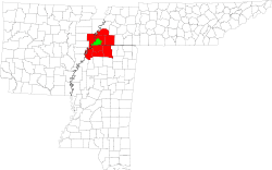 | ||||||||||
| U.S. Highways | |||||||||||
| State Highways |
| ||||||||||
| Other Highways | |||||||||||
This article is issued from Wikipedia - version of the 10/18/2016. The text is available under the Creative Commons Attribution/Share Alike but additional terms may apply for the media files.